Guintubhan geodata
Guintubhan (Western Visayas) is a populated place; located in Philippines in Asia/Manila (GMT+8) time zone. With population of 2,330 people, there are 3610 cities with bigger population in this country. Compared to other cities in Philippines, 66.2% of cities are located further ↑North; 52.6% of cities are located further ←West and 54.5% of cities have higher elevation than Guintubhan. Note1
Administrative division(s):
- Level 1: Western Visayas
- Level 2: Province of Negros Occidental
- Level 3: Isabela


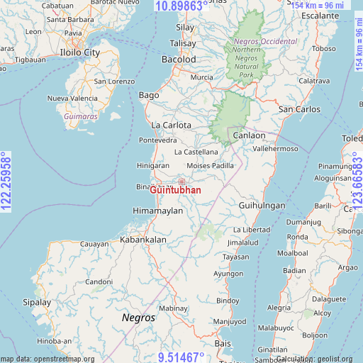
Guintubhan GPS coordinates[2]
10° 12' 26.64" North, 122° 57' 45.72" East
| Map corner | latitude | longitude |
|---|---|---|
| Upper-left | 10.89863°, | 122.25958° |
| Center: | 10.2074°, | 122.9627° |
| Lower-right: | 9.51467°, | 123.66583° |
| Map W x H: | 153.9×153.9 km | = 95.6×95.6mi |
| max Lat: | 20.78733° ⇑66.2% North |
| Guintubhan: | 10.2074° |
| min Lat: | ⇓33.8% South 4.65442° |
| min Long | Guintubhan | max Long |
| 117.04868° | 122.9627° | 126.58417° |
| W 52.6%⇐ | ⇒47.4% E |
Elevation
Elevation of Guintubhan is 20 m = 66 ft, and this is 67.9 m = 223 ft below average elevation for this country.
| Max E: |
2262 m = 7421 ft | 54.5% |
| Avg. | 87.9 m = 288 ft | |
| Guintubhan | 20 m = 66 ft | |
Min E: |
-2 m = -7 ft | 45.5% |
See also: Philippines elevation on elevation.city.
Geographical zone
Guintubhan is located in North Torrid zone (between Equator and Tropic of Cancer). Distance of Equator is 1135 km =705.3 mi to South.| Distance of | km | miles | from Guintubhan |
|---|---|---|---|
| North Pole | 8872.1 | 5512.9 | to North |
| Arctic Circle | 6266.2 | 3893.6 | to North |
| Tropic Cancer | 1471 | 914 | to North |
| Equator | 1135 | 705.3 | to South |


Nearby cities:
15 places around Guintubhan: (largest is in red/bold)
• Aranda
3.7 km =2.3 mi,  331°
331°
• Bagroy
2.9 km =1.8 mi,  260°
260°
• Bulad
6.6 km =4.1 mi,  36°
36°
• Cabadiangan
7.2 km =4.5 mi,  197°
197°
• Calape
7.5 km =4.7 mi,  9°
9°
• Camalobalo
7.4 km =4.6 mi,  349°
349°
• Camangcamang
4.1 km =2.5 mi,  140°
140°
• Cansolungon
7.4 km =4.6 mi,  148°
148°
• Isabela
2.9 km =1.8 mi,  95°
95°
• Libacao
6.2 km =3.9 mi,  240°
240°
• Montilla
4 km =2.5 mi, 262°
• Patique
7.7 km =4.8 mi,  295°
295°
• Payao
5.4 km =3.4 mi,  233°
233°
• Santol
5.2 km =3.2 mi, 137°
• Tinongan
8 km =5 mi,  83°
83°
Sources, notices
• [Note1] Compared only with cities in Philippines existing in our database
• [Src1] Map data: © OpenStreetMap contributors (CC-BY-SA)
• [Src2] Other city data from geonames.org with taken over terms of usage.
• [Src3] Geographical zone / Annual Mean Temperature by Robert A. Rohde @ Wikipedia
