Guinsang-an geodata
Guinsang-an (Soccsksargen) is a populated place; located in Philippines in Asia/Manila (GMT+8) time zone. With population of 3,847 people, there are 1811 cities with bigger population in this country. Compared to other cities in Philippines, 95.9% of cities are located further ↑North; 82.1% of cities are located further ←West and 84.4% of cities have lower elevation than Guinsang-an. Note1
Administrative division(s):
- Level 1: Soccsksargen
- Level 2: Province of South Cotabato
- Level 3: Santo Niño


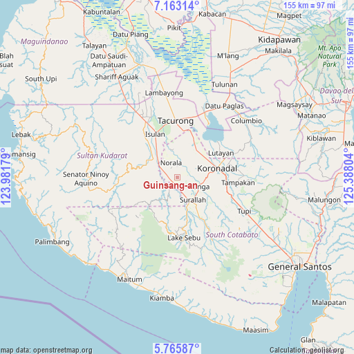
Guinsang-an GPS coordinates[2]
6° 27' 53.964" North, 124° 41' 5.676" East
| Map corner | latitude | longitude |
|---|---|---|
| Upper-left | 7.16314°, | 123.98179° |
| Center: | 6.46499°, | 124.68491° |
| Lower-right: | 5.76587°, | 125.38804° |
| Map W x H: | 155.4×155.4 km | = 96.6×96.6mi |
| max Lat: | 20.78733° ⇑95.9% North |
| Guinsang-an: | 6.46499° |
| min Lat: | ⇓4.1% South 4.65442° |
| min Long | Guinsang-an | max Long |
| 117.04868° | 124.68491° | 126.58417° |
| W 82.1%⇐ | ⇒17.9% E |
Elevation
Elevation of Guinsang-an is 128 m = 420 ft, and this is 40.1 m = 132 ft above average elevation for this country.
| Max E: |
2262 m = 7421 ft | 15.6% |
| Guinsang-an | 128 m 420 ft | |
| Avg. | 87.9 m = 288 ft | |
Min E: |
-2 m = -7 ft | 84.4% |
See also: Philippines elevation on elevation.city.
Geographical zone
Guinsang-an is located in North Torrid zone (between Equator and Tropic of Cancer). Distance of Equator is 718.8 km =446.6 mi to South.| Distance of | km | miles | from Guinsang-an |
|---|---|---|---|
| North Pole | 9288.2 | 5771.4 | to North |
| Arctic Circle | 6682.3 | 4152.2 | to North |
| Tropic Cancer | 1887.1 | 1172.6 | to North |
| Equator | 718.8 | 446.6 | to South |


Nearby cities:
15 places around Guinsang-an: (largest is in red/bold)
• Bañga
11.3 km =7 mi,  113°
113°
• Busok
10.5 km =6.5 mi,  297°
297°
• Dahay
8.9 km =5.5 mi,  158°
158°
• Esperanza
4.2 km =2.6 mi,  332°
332°
• Kolumbug
10.7 km =6.6 mi,  307°
307°
• Lapuz
6.8 km =4.2 mi, 298°
• Liberty
8.5 km =5.3 mi,  316°
316°
• Lopez Jaena
1.9 km =1.2 mi,  50°
50°
• Manuel Roxas
3.3 km =2.1 mi,  218°
218°
• Norala
7 km =4.3 mi,  336°
336°
• Panay
6.3 km =3.9 mi, 304°
• San Miguel
3.3 km =2.1 mi,  22°
22°
• San Vicente
10.6 km =6.6 mi,  96°
96°
• Santo Niño
3.6 km =2.2 mi, 157°
• Teresita
6.2 km =3.9 mi, 155°
Sources, notices
• [Note1] Compared only with cities in Philippines existing in our database
• [Src1] Map data: © OpenStreetMap contributors (CC-BY-SA)
• [Src2] Other city data from geonames.org with taken over terms of usage.
• [Src3] Geographical zone / Annual Mean Temperature by Robert A. Rohde @ Wikipedia
