Manuel Roxas geodata
Manuel Roxas (Soccsksargen) is a populated place; located in Philippines in Asia/Manila (GMT+8) time zone. With population of 4,482 people, there are 1504 cities with bigger population in this country. Compared to other cities in Philippines, 96.1% of cities are located further ↑North; 81.9% of cities are located further ←West and 85% of cities have lower elevation than Manuel Roxas. Note1
Administrative division(s):
- Level 1: Soccsksargen
- Level 2: Province of South Cotabato
- Level 3: Santo Niño


Manuel Roxas GPS coordinates[2]
6° 26' 30.228" North, 124° 39' 57.78" East
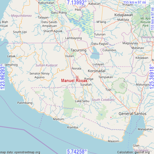
| Map corner | latitude | longitude |
|---|---|---|
| Upper-left | 7.13992°, | 123.96293° |
| Center: | 6.44173°, | 124.66605° |
| Lower-right: | 5.74258°, | 125.36918° |
| Map W x H: | 155.4×155.4 km | = 96.6×96.6mi |
| max Lat: | 20.78733° ⇑96.1% North |
| Manuel Roxas: | 6.44173° |
| min Lat: | ⇓3.9% South 4.65442° |
| min Long | Manuel Roxas | max Long |
| 117.04868° | 124.66605° | 126.58417° |
| W 81.9%⇐ | ⇒18.1% E |
Elevation
Elevation of Manuel Roxas is 138 m = 453 ft, and this is 50.1 m = 164 ft above average elevation for this country.
| Max E: |
2262 m = 7421 ft | 15% |
| Manuel Roxas | 138 m 453 ft | |
| Avg. | 87.9 m = 288 ft | |
Min E: |
-2 m = -7 ft | 85% |
See also: Philippines elevation on elevation.city.
Geographical zone
Manuel Roxas is located in North Torrid zone (between Equator and Tropic of Cancer). Distance of Equator is 716.3 km =445.1 mi to South.| Distance of | km | miles | from Manuel Roxas |
|---|---|---|---|
| North Pole | 9290.8 | 5773 | to North |
| Arctic Circle | 6684.9 | 4153.8 | to North |
| Tropic Cancer | 1889.7 | 1174.2 | to North |
| Equator | 716.3 | 445.1 | to South |


Nearby cities:
15 places around Manuel Roxas: (largest is in red/bold)
• Busok
10.4 km =6.5 mi,  315°
315°
• Dahay
7.8 km =4.8 mi,  136°
136°
• Esperanza
6.3 km =3.9 mi,  1°
1°
• Guinsang-an
3.3 km =2.1 mi,  38°
38°
• Kolumbug
11.1 km =6.9 mi,  325°
325°
• Lapuz
7 km =4.3 mi, 326°
• Liberty
9.5 km =5.9 mi,  336°
336°
• Lopez Jaena
5.2 km =3.2 mi, 43°
• Norala
9 km =5.6 mi,  355°
355°
• Panay
6.9 km =4.3 mi, 333°
• San Miguel
6.6 km =4.1 mi,  30°
30°
• Santo Niño
3.6 km =2.2 mi,  102°
102°
• Surallah
11.5 km =7.1 mi,  130°
130°
• Teresita
5.5 km =3.4 mi,  123°
123°
• Tuka
12.2 km =7.6 mi,  314°
314°
Sources, notices
• [Note1] Compared only with cities in Philippines existing in our database
• [Src1] Map data: © OpenStreetMap contributors (CC-BY-SA)
• [Src2] Other city data from geonames.org with taken over terms of usage.
• [Src3] Geographical zone / Annual Mean Temperature by Robert A. Rohde @ Wikipedia
