Bungahan geodata
Bungahan (Calabarzon) is a populated place; located in Philippines in Asia/Manila (GMT+8) time zone. With population of 3,340 people, there are 2187 cities with bigger population in this country. Compared to other cities in Philippines, 68.2% of cities are located further ↓South; 86.1% of cities are located further →East and 70% of cities have lower elevation than Bungahan. Note1


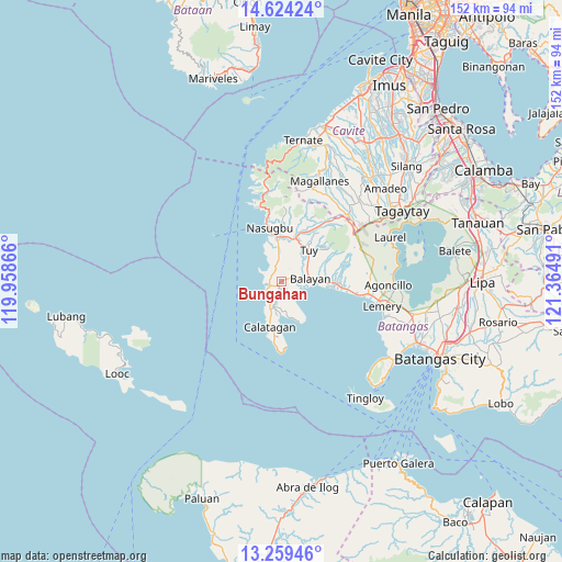
Bungahan GPS coordinates[2]
13° 56' 34.296" North, 120° 39' 42.408" East
| Map corner | latitude | longitude |
|---|---|---|
| Upper-left | 14.62424°, | 119.95866° |
| Center: | 13.94286°, | 120.66178° |
| Lower-right: | 13.25946°, | 121.36491° |
| Map W x H: | 151.7×151.8 km | = 94.3×94.3mi |
| max Lat: | 20.78733° ⇑31.8% North |
| Bungahan: | 13.94286° |
| min Lat: | ⇓68.2% South 4.65442° |
| min Long | Bungahan | max Long |
| 117.04868° | 120.66178° | 126.58417° |
| W 13.9%⇐ | ⇒86.1% E |
Elevation
Elevation of Bungahan is 52 m = 171 ft, and this is 35.9 m = 118 ft below average elevation for this country.
| Max E: |
2262 m = 7421 ft | 30% |
| Avg. | 87.9 m = 288 ft | |
| Bungahan | 52 m = 171 ft | |
Min E: |
-2 m = -7 ft | 70% |
See also: Philippines elevation on elevation.city.
Geographical zone
Bungahan is located in North Torrid zone (between Equator and Tropic of Cancer). Distance of this Northern Tropic circle is 1055.6 km =655.9 mi to North.| Distance of | km | miles | from Bungahan |
|---|---|---|---|
| North Pole | 8456.8 | 5254.8 | to North |
| Arctic Circle | 5850.9 | 3635.6 | to North |
| Tropic Cancer | 1055.6 | 655.9 | to North |
| Equator | 1550.3 | 963.3 | to South |


Nearby cities:
15 places around Bungahan: (largest is in red/bold)
• Balayan
7.6 km =4.7 mi,  94°
94°
• Balibago
4.3 km =2.7 mi,  244°
244°
• Balitoc
9.4 km =5.8 mi,  197°
197°
• Biga
4.5 km =2.8 mi, 198°
• Bilaran
11.5 km =7.1 mi,  26°
26°
• Binubusan
4.1 km =2.5 mi,  316°
316°
• Gulod
8.1 km =5 mi, 202°
• Lian
10.2 km =6.3 mi,  352°
352°
• Lucsuhin
7.1 km =4.4 mi, 198°
• Luntal
11.3 km =7 mi, 32°
• Malaruhatan
10 km =6.2 mi,  11°
11°
• Prinza
6.1 km =3.8 mi, 352°
• Putol
9 km =5.6 mi,  52°
52°
• Talisay
5.2 km =3.2 mi,  233°
233°
• Tuy
11.1 km =6.9 mi,  41°
41°
Sources, notices
• [Note1] Compared only with cities in Philippines existing in our database
• [Src1] Map data: © OpenStreetMap contributors (CC-BY-SA)
• [Src2] Other city data from geonames.org with taken over terms of usage.
• [Src3] Geographical zone / Annual Mean Temperature by Robert A. Rohde @ Wikipedia
