Aguilar geodata
Aguilar (Ilocos) is a seat of a third-order administrative division; located in Philippines in Asia/Manila (GMT+8) time zone. With population of 9,801 people, there are 622 cities with bigger population in this country. Compared to other cities in Philippines, 86% of cities are located further ↓South; 95.9% of cities are located further →East and 70.2% of cities have higher elevation than Aguilar. Note1


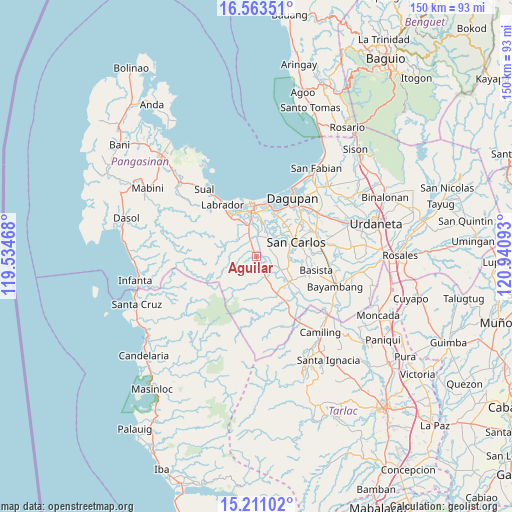
Aguilar GPS coordinates[2]
15° 53' 18.24" North, 120° 14' 16.08" East
| Map corner | latitude | longitude |
|---|---|---|
| Upper-left | 16.56351°, | 119.53468° |
| Center: | 15.8884°, | 120.2378° |
| Lower-right: | 15.21102°, | 120.94093° |
| Map W x H: | 150.4×150.4 km | = 93.5×93.5mi |
| max Lat: | 20.78733° ⇑14% North |
| Aguilar: | 15.8884° |
| min Lat: | ⇓86% South 4.65442° |
| min Long | Aguilar | max Long |
| 117.04868° | 120.2378° | 126.58417° |
| W 4.1%⇐ | ⇒95.9% E |
Elevation
Elevation of Aguilar is 12 m = 39 ft, and this is 75.9 m = 249 ft below average elevation for this country.
| Max E: |
2262 m = 7421 ft | 70.2% |
| Avg. | 87.9 m = 288 ft | |
| Aguilar | 12 m = 39 ft | |
Min E: |
-2 m = -7 ft | 29.8% |
See also: Philippines elevation on elevation.city.
Geographical zone
Aguilar is located in North Torrid zone (between Equator and Tropic of Cancer). Distance of this Northern Tropic circle is 839.3 km =521.5 mi to North.| Distance of | km | miles | from Aguilar |
|---|---|---|---|
| North Pole | 8240.4 | 5120.3 | to North |
| Arctic Circle | 5634.5 | 3501.1 | to North |
| Tropic Cancer | 839.3 | 521.5 | to North |
| Equator | 1766.6 | 1097.7 | to South |


Nearby cities:
15 places around Aguilar: (largest is in red/bold)
• Bayaoas
6.7 km =4.2 mi,  154°
154°
• Bugallon
7.5 km =4.7 mi,  341°
341°
• Calomboyan
9.5 km =5.9 mi,  47°
47°
• Calsib
5.4 km =3.4 mi, 148°
• Hacienda
8.3 km =5.2 mi,  309°
309°
• Isla
6.8 km =4.2 mi,  83°
83°
• Laguit Centro
8.3 km =5.2 mi,  322°
322°
• Libas
8.5 km =5.3 mi,  97°
97°
• Linmansangan
9 km =5.6 mi,  136°
136°
• Malawa
8.8 km =5.5 mi,  28°
28°
• Ninoy
3.4 km =2.1 mi,  161°
161°
• Pangpang
9.5 km =5.9 mi, 53°
• Pogonsili
7.9 km =4.9 mi, 162°
• Tamayo
5.1 km =3.2 mi, 103°
• Umanday Centro
6 km =3.7 mi, 336°
Sources, notices
• [Note1] Compared only with cities in Philippines existing in our database
• [Src1] Map data: © OpenStreetMap contributors (CC-BY-SA)
• [Src2] Other city data from geonames.org with taken over terms of usage.
• [Src3] Geographical zone / Annual Mean Temperature by Robert A. Rohde @ Wikipedia
