Sanga-Sanga geodata
Sanga-Sanga (Autonomous Region in Muslim Mindanao) is a populated place; located in Philippines in Asia/Manila (GMT+8) time zone. With population of 5,295 people, there are 1202 cities with bigger population in this country. Compared to other cities in Philippines, 99.6% of cities are located further ↑North; 98.5% of cities are located further →East and 80.4% of cities have lower elevation than Sanga-Sanga. Note1
Administrative division(s):
- Level 1: Autonomous Region in Muslim Mindanao
- Level 2: Province of Tawi-Tawi
- Level 3: Bongao


Sanga-Sanga GPS coordinates[2]
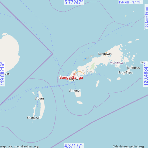
5° 4' 21" North, 119° 47' 7.008" East
| Map corner | latitude | longitude |
|---|---|---|
| Upper-left | 5.77247°, | 119.08216° |
| Center: | 5.0725°, | 119.78528° |
| Lower-right: | 4.37177°, | 120.48841° |
| Map W x H: | 155.7×155.7 km | = 96.7×96.7mi |
| max Lat: | 20.78733° ⇑99.6% North |
| Sanga-Sanga: | 5.0725° |
| min Lat: | ⇓0.4% South 4.65442° |
| min Long | Sanga-Sanga | max Long |
| 117.04868° | 119.78528° | 126.58417° |
| W 1.5%⇐ | ⇒98.5% E |
Elevation
Elevation of Sanga-Sanga is 94 m = 308 ft, and this is 6.1 m = 20 ft above average elevation for this country.
| Max E: |
2262 m = 7421 ft | 19.6% |
| Sanga-Sanga | 94 m 308 ft | |
| Avg. | 87.9 m = 288 ft | |
Min E: |
-2 m = -7 ft | 80.4% |
See also: Philippines elevation on elevation.city.
Geographical zone
Sanga-Sanga is located in North Torrid zone (between Equator and Tropic of Cancer). Distance of Equator is 564 km =350.5 mi to South.| Distance of | km | miles | from Sanga-Sanga |
|---|---|---|---|
| North Pole | 9443.1 | 5867.7 | to North |
| Arctic Circle | 6837.2 | 4248.4 | to North |
| Tropic Cancer | 2041.9 | 1268.8 | to North |
| Equator | 564 | 350.5 | to South |


Nearby cities:
15 places around Sanga-Sanga: (largest is in red/bold)
• Bakung
20.2 km =12.6 mi,  177°
177°
• Balimbing
20 km =12.4 mi,  86°
86°
• Bankaw
25.5 km =15.8 mi,  103°
103°
• Bongao
5 km =3.1 mi,  195°
195°
• Buan
30.1 km =18.7 mi,  70°
70°
• Kolape
12.4 km =7.7 mi, 91°
• Languyan
38.9 km =24.2 mi,  57°
57°
• Lookan
35.4 km =22 mi, 96°
• Luuk Datan
29.7 km =18.5 mi,  167°
167°
• Manuk Mangkaw
31.1 km =19.3 mi, 166°
• New Batu Batu
10.9 km =6.8 mi, 93°
• Parangan
17 km =10.6 mi, 85°
• Simunul
20.6 km =12.8 mi,  159°
159°
• Tampakan
16.7 km =10.4 mi, 176°
• Ungus-Ungus
6.5 km =4 mi,  111°
111°
Sources, notices
• [Note1] Compared only with cities in Philippines existing in our database
• [Src1] Map data: © OpenStreetMap contributors (CC-BY-SA)
• [Src2] Other city data from geonames.org with taken over terms of usage.
• [Src3] Geographical zone / Annual Mean Temperature by Robert A. Rohde @ Wikipedia
