Panubigan geodata
Panubigan (Zamboanga Peninsula) is a populated place; located in Philippines in Asia/Manila (GMT+8) time zone. With population of 2,110 people, there are 4059 cities with bigger population in this country. Compared to other cities in Philippines, 87.6% of cities are located further ↑North; 59.3% of cities are located further ←West and 81.1% of cities have lower elevation than Panubigan. Note1
Administrative division(s):
- Level 1: Zamboanga Peninsula
- Level 2: Province of Zamboanga del Sur
- Level 3: Pitogo


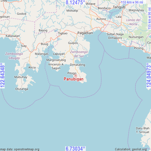
Panubigan GPS coordinates[2]
7° 25' 41.16" North, 123° 20' 47.76" East
| Map corner | latitude | longitude |
|---|---|---|
| Upper-left | 8.12475°, | 122.64348° |
| Center: | 7.4281°, | 123.3466° |
| Lower-right: | 6.73034°, | 124.04973° |
| Map W x H: | 155×155 km | = 96.3×96.3mi |
| max Lat: | 20.78733° ⇑87.6% North |
| Panubigan: | 7.4281° |
| min Lat: | ⇓12.4% South 4.65442° |
| min Long | Panubigan | max Long |
| 117.04868° | 123.3466° | 126.58417° |
| W 59.3%⇐ | ⇒40.7% E |
Elevation
Elevation of Panubigan is 100 m = 328 ft, and this is 12.1 m = 40 ft above average elevation for this country.
| Max E: |
2262 m = 7421 ft | 18.9% |
| Panubigan | 100 m 328 ft | |
| Avg. | 87.9 m = 288 ft | |
Min E: |
-2 m = -7 ft | 81.1% |
See also: Philippines elevation on elevation.city.
Geographical zone
Panubigan is located in North Torrid zone (between Equator and Tropic of Cancer). Distance of Equator is 825.9 km =513.2 mi to South.| Distance of | km | miles | from Panubigan |
|---|---|---|---|
| North Pole | 9181.1 | 5704.9 | to North |
| Arctic Circle | 6575.2 | 4085.6 | to North |
| Tropic Cancer | 1780 | 1106 | to North |
| Equator | 825.9 | 513.2 | to South |


Nearby cities:
15 places around Panubigan: (largest is in red/bold)
• Binuatan
20.5 km =12.7 mi,  359°
359°
• Dimataling
12.2 km =7.6 mi,  14°
14°
• East Migpulao
22.8 km =14.2 mi,  3°
3°
• Guiniculalay
25.8 km =16 mi, 11°
• Kalian
22.1 km =13.7 mi,  325°
325°
• Lapuyan
28.7 km =17.8 mi,  324°
324°
• Legrada
23.3 km =14.5 mi,  348°
348°
• Lumbog
21.6 km =13.4 mi,  312°
312°
• Malim
9.7 km =6 mi,  74°
74°
• Margosatubig
26 km =16.2 mi, 309°
• Pitogo
4.9 km =3 mi, 306°
• Sagacad
28.7 km =17.8 mi, 358°
• San Miguel
26 km =16.2 mi,  340°
340°
• San Pablo
28.3 km =17.6 mi,  26°
26°
• Tabina
8 km =5 mi,  57°
57°
Sources, notices
• [Note1] Compared only with cities in Philippines existing in our database
• [Src1] Map data: © OpenStreetMap contributors (CC-BY-SA)
• [Src2] Other city data from geonames.org with taken over terms of usage.
• [Src3] Geographical zone / Annual Mean Temperature by Robert A. Rohde @ Wikipedia
