Guiniculalay geodata
Guiniculalay (Zamboanga Peninsula) is a populated place; located in Philippines in Asia/Manila (GMT+8) time zone. With population of 2,147 people, there are 3993 cities with bigger population in this country. Compared to other cities in Philippines, 85.5% of cities are located further ↑North; 60.1% of cities are located further ←West and 88.2% of cities have lower elevation than Guiniculalay. Note1
Administrative division(s):
- Level 1: Zamboanga Peninsula
- Level 2: Province of Zamboanga del Sur
- Level 3: San Pablo


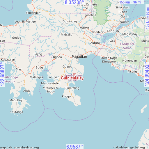
Guiniculalay GPS coordinates[2]
7° 39' 21.996" North, 123° 23' 29.004" East
| Map corner | latitude | longitude |
|---|---|---|
| Upper-left | 8.35238°, | 122.68827° |
| Center: | 7.65611°, | 123.39139° |
| Lower-right: | 6.9587°, | 124.09452° |
| Map W x H: | 155×155 km | = 96.3×96.3mi |
| max Lat: | 20.78733° ⇑85.5% North |
| Guiniculalay: | 7.65611° |
| min Lat: | ⇓14.5% South 4.65442° |
| min Long | Guiniculalay | max Long |
| 117.04868° | 123.39139° | 126.58417° |
| W 60.1%⇐ | ⇒39.9% E |
Elevation
Elevation of Guiniculalay is 185 m = 607 ft, and this is 97.1 m = 319 ft above average elevation for this country.
| Max E: |
2262 m = 7421 ft | 11.8% |
| Guiniculalay | 185 m 607 ft | |
| Avg. | 87.9 m = 288 ft | |
Min E: |
-2 m = -7 ft | 88.2% |
See also: Philippines elevation on elevation.city.
Geographical zone
Guiniculalay is located in North Torrid zone (between Equator and Tropic of Cancer). Distance of Equator is 851.3 km =529 mi to South.| Distance of | km | miles | from Guiniculalay |
|---|---|---|---|
| North Pole | 9155.8 | 5689.1 | to North |
| Arctic Circle | 6549.9 | 4069.9 | to North |
| Tropic Cancer | 1754.6 | 1090.3 | to North |
| Equator | 851.3 | 529 | to South |


Nearby cities:
15 places around Guiniculalay: (largest is in red/bold)
• Binuatan
7.1 km =4.4 mi,  226°
226°
• Dimataling
13.7 km =8.5 mi,  188°
188°
• Dumalinao
18.3 km =11.4 mi,  352°
352°
• East Migpulao
4.4 km =2.7 mi, 233°
• Guipos
10.2 km =6.3 mi,  311°
311°
• Kalian
19 km =11.8 mi,  247°
247°
• Legrada
9.9 km =6.2 mi,  255°
255°
• Muricay
21.3 km =13.2 mi,  26°
26°
• Pagadian
19.5 km =12.1 mi,  14°
14°
• Robonkon
11.2 km =7 mi,  15°
15°
• Sagacad
6.5 km =4 mi,  300°
300°
• San Miguel
13.7 km =8.5 mi,  266°
266°
• San Pablo
7.7 km =4.8 mi,  89°
89°
• Tabina
21.1 km =13.1 mi,  174°
174°
• Tiguha
20.5 km =12.7 mi,  285°
285°
Sources, notices
• [Note1] Compared only with cities in Philippines existing in our database
• [Src1] Map data: © OpenStreetMap contributors (CC-BY-SA)
• [Src2] Other city data from geonames.org with taken over terms of usage.
• [Src3] Geographical zone / Annual Mean Temperature by Robert A. Rohde @ Wikipedia
