Lumbac geodata
Lumbac (Autonomous Region in Muslim Mindanao) is a populated place; located in Philippines in Asia/Manila (GMT+8) time zone. With population of 2,448 people, there are 3384 cities with bigger population in this country. Compared to other cities in Philippines, 84.9% of cities are located further ↑North; 74.5% of cities are located further ←West and 98.1% of cities have lower elevation than Lumbac. Note1
Administrative division(s):
- Level 1: Autonomous Region in Muslim Mindanao
- Level 2: Province of Lanao del Sur
- Level 3: Sultan Dumalondong


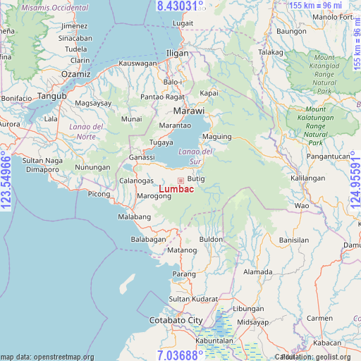
Lumbac GPS coordinates[2]
7° 44' 3.012" North, 124° 15' 10.008" East
| Map corner | latitude | longitude |
|---|---|---|
| Upper-left | 8.43031°, | 123.54966° |
| Center: | 7.73417°, | 124.25278° |
| Lower-right: | 7.03688°, | 124.95591° |
| Map W x H: | 154.9×154.9 km | = 96.3×96.3mi |
| max Lat: | 20.78733° ⇑84.9% North |
| Lumbac: | 7.73417° |
| min Lat: | ⇓15.1% South 4.65442° |
| min Long | Lumbac | max Long |
| 117.04868° | 124.25278° | 126.58417° |
| W 74.5%⇐ | ⇒25.5% E |
Elevation
Elevation of Lumbac is 744 m = 2441 ft, and this is 656.1 m = 2153 ft above average elevation for this country.
| Max E: |
2262 m = 7421 ft | 1.9% |
| Lumbac | 744 m 2441 ft | |
| Avg. | 87.9 m = 288 ft | |
Min E: |
-2 m = -7 ft | 98.1% |
See also: Philippines elevation on elevation.city.
Geographical zone
Lumbac is located in North Torrid zone (between Equator and Tropic of Cancer). Distance of Equator is 860 km =534.4 mi to South.| Distance of | km | miles | from Lumbac |
|---|---|---|---|
| North Pole | 9147.1 | 5683.7 | to North |
| Arctic Circle | 6541.2 | 4064.5 | to North |
| Tropic Cancer | 1746 | 1084.9 | to North |
| Equator | 860 | 534.4 | to South |


Nearby cities:
15 places around Lumbac: (largest is in red/bold)
• Bacayawan
4.2 km =2.6 mi,  329°
329°
• Bayang
9.4 km =5.8 mi,  314°
314°
• Binidayan
12.3 km =7.6 mi, 310°
• Bualan
2.3 km =1.4 mi,  41°
41°
• Butig
5.4 km =3.4 mi,  101°
101°
• Calanogas
16.9 km =10.5 mi,  275°
275°
• Ganassi
19.4 km =12.1 mi,  302°
302°
• Lumbatan
5.7 km =3.5 mi,  4°
4°
• Lumbayanague
6.2 km =3.9 mi,  29°
29°
• Madamba
19.5 km =12.1 mi, 306°
• Marogong
13.6 km =8.5 mi,  236°
236°
• Masiu
11.2 km =7 mi, 39°
• Tamparan
18.4 km =11.4 mi, 28°
• Tubaran
10.2 km =6.3 mi,  290°
290°
• Tugaya
18.7 km =11.6 mi, 332°
Sources, notices
• [Note1] Compared only with cities in Philippines existing in our database
• [Src1] Map data: © OpenStreetMap contributors (CC-BY-SA)
• [Src2] Other city data from geonames.org with taken over terms of usage.
• [Src3] Geographical zone / Annual Mean Temperature by Robert A. Rohde @ Wikipedia
