Marogong geodata
Marogong (Autonomous Region in Muslim Mindanao) is a seat of a third-order administrative division; located in Philippines in Asia/Manila (GMT+8) time zone. With population of 3,785 people, there are 1856 cities with bigger population in this country. Compared to other cities in Philippines, 85.4% of cities are located further ↑North; 73.4% of cities are located further ←West and 94.9% of cities have lower elevation than Marogong. Note1
Administrative division(s):
- Level 1: Autonomous Region in Muslim Mindanao
- Level 2: Province of Lanao del Sur
- Level 3: Marogong


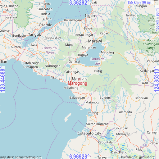
Marogong GPS coordinates[2]
7° 40' 0.012" North, 124° 9' 0" East
| Map corner | latitude | longitude |
|---|---|---|
| Upper-left | 8.36292°, | 123.44688° |
| Center: | 7.66667°, | 124.15° |
| Lower-right: | 6.96928°, | 124.85313° |
| Map W x H: | 155×155 km | = 96.3×96.3mi |
| max Lat: | 20.78733° ⇑85.4% North |
| Marogong: | 7.66667° |
| min Lat: | ⇓14.6% South 4.65442° |
| min Long | Marogong | max Long |
| 117.04868° | 124.15° | 126.58417° |
| W 73.4%⇐ | ⇒26.6% E |
Elevation
Elevation of Marogong is 404 m = 1325 ft, and this is 316.1 m = 1037 ft above average elevation for this country.
| Max E: |
2262 m = 7421 ft | 5.1% |
| Marogong | 404 m 1325 ft | |
| Avg. | 87.9 m = 288 ft | |
Min E: |
-2 m = -7 ft | 94.9% |
See also: Philippines elevation on elevation.city.
Geographical zone
Marogong is located in North Torrid zone (between Equator and Tropic of Cancer). Distance of Equator is 852.5 km =529.7 mi to South.| Distance of | km | miles | from Marogong |
|---|---|---|---|
| North Pole | 9154.6 | 5688.4 | to North |
| Arctic Circle | 6548.7 | 4069.2 | to North |
| Tropic Cancer | 1753.5 | 1089.6 | to North |
| Equator | 852.5 | 529.7 | to South |


Nearby cities:
15 places around Marogong: (largest is in red/bold)
• Bacayawan
14.4 km =8.9 mi,  39°
39°
• Balabagan
16.1 km =10 mi,  194°
194°
• Bayang
14.8 km =9.2 mi,  18°
18°
• Binidayan
15.7 km =9.8 mi,  7°
7°
• Bualan
15.8 km =9.8 mi,  54°
54°
• Butig
17.8 km =11.1 mi,  68°
68°
• Calanogas
10.8 km =6.7 mi,  329°
329°
• Ganassi
18.5 km =11.5 mi,  343°
343°
• Lumbac
13.6 km =8.5 mi,  56°
56°
• Lumbatan
17.6 km =10.9 mi, 41°
• Lumbayanague
19.3 km =12 mi, 48°
• Madamba
19.6 km =12.2 mi,  347°
347°
• Malabang
12.2 km =7.6 mi,  225°
225°
• Pualas
18.8 km =11.7 mi, 332°
• Tubaran
11.3 km =7 mi, 9°
Sources, notices
• [Note1] Compared only with cities in Philippines existing in our database
• [Src1] Map data: © OpenStreetMap contributors (CC-BY-SA)
• [Src2] Other city data from geonames.org with taken over terms of usage.
• [Src3] Geographical zone / Annual Mean Temperature by Robert A. Rohde @ Wikipedia
