Yeban Norte geodata
Yeban Norte (Cagayan Valley) is a populated place; located in Philippines in Asia/Manila (GMT+8) time zone. With population of 3,557 people, there are 2013 cities with bigger population in this country. Compared to other cities in Philippines, 93.6% of cities are located further ↓South; 61% of cities are located further →East and 71.5% of cities have lower elevation than Yeban Norte. Note1
Administrative division(s):
- Level 1: Cagayan Valley
- Level 2: Province of Isabela
- Level 3: Benito Soliven


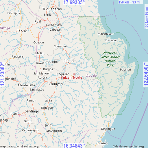
Yeban Norte GPS coordinates[2]
17° 1' 19.02" North, 121° 56' 30.984" East
| Map corner | latitude | longitude |
|---|---|---|
| Upper-left | 17.69305°, | 121.23882° |
| Center: | 17.02195°, | 121.94194° |
| Lower-right: | 16.34843°, | 122.64507° |
| Map W x H: | 149.5×149.5 km | = 92.9×92.9mi |
| max Lat: | 20.78733° ⇑6.4% North |
| Yeban Norte: | 17.02195° |
| min Lat: | ⇓93.6% South 4.65442° |
| min Long | Yeban Norte | max Long |
| 117.04868° | 121.94194° | 126.58417° |
| W 39%⇐ | ⇒61% E |
Elevation
Elevation of Yeban Norte is 56 m = 184 ft, and this is 31.9 m = 105 ft below average elevation for this country.
| Max E: |
2262 m = 7421 ft | 28.5% |
| Avg. | 87.9 m = 288 ft | |
| Yeban Norte | 56 m = 184 ft | |
Min E: |
-2 m = -7 ft | 71.5% |
See also: Philippines elevation on elevation.city.
Geographical zone
Yeban Norte is located in North Torrid zone (between Equator and Tropic of Cancer). Distance of this Northern Tropic circle is 713.3 km =443.2 mi to North.| Distance of | km | miles | from Yeban Norte |
|---|---|---|---|
| North Pole | 8114.4 | 5042.1 | to North |
| Arctic Circle | 5508.5 | 3422.8 | to North |
| Tropic Cancer | 713.3 | 443.2 | to North |
| Equator | 1892.7 | 1176.1 | to South |


Nearby cities:
15 places around Yeban Norte: (largest is in red/bold)
• Alibago
13.2 km =8.2 mi,  322°
322°
• Benito Soliven
4.9 km =3 mi,  156°
156°
• Cabannungan Second
15 km =9.3 mi, 319°
• Daragutan
10 km =6.2 mi,  104°
104°
• Furao
15.5 km =9.6 mi,  275°
275°
• Gamu
11.7 km =7.3 mi,  285°
285°
• Ilagan
15.1 km =9.4 mi,  338°
338°
• Maluno Sur
3.5 km =2.2 mi,  137°
137°
• Minallo
10.1 km =6.3 mi,  247°
247°
• Naguilian
11.2 km =7 mi,  270°
270°
• Reina Mercedes
12.9 km =8 mi, 251°
• San Luis
13.7 km =8.5 mi,  242°
242°
• San Mariano
8.8 km =5.5 mi,  119°
119°
• Sindon
8.9 km =5.5 mi,  61°
61°
• Upi
13.3 km =8.3 mi,  300°
300°
Sources, notices
• [Note1] Compared only with cities in Philippines existing in our database
• [Src1] Map data: © OpenStreetMap contributors (CC-BY-SA)
• [Src2] Other city data from geonames.org with taken over terms of usage.
• [Src3] Geographical zone / Annual Mean Temperature by Robert A. Rohde @ Wikipedia
