Sindon geodata
Sindon (Cagayan Valley) is a populated place; located in Philippines in Asia/Manila (GMT+8) time zone. With population of 2,418 people, there are 3433 cities with bigger population in this country. Compared to other cities in Philippines, 93.9% of cities are located further ↓South; 60% of cities are located further →East and 76.6% of cities have lower elevation than Sindon. Note1
Administrative division(s):
- Level 1: Cagayan Valley
- Level 2: Province of Isabela
- Level 3: Ilagan City


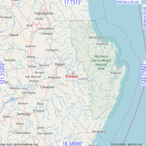
Sindon GPS coordinates[2]
17° 3' 37.224" North, 122° 0' 54.504" East
| Map corner | latitude | longitude |
|---|---|---|
| Upper-left | 17.7313°, | 121.31202° |
| Center: | 17.06034°, | 122.01514° |
| Lower-right: | 16.38696°, | 122.71827° |
| Map W x H: | 149.5×149.5 km | = 92.9×92.9mi |
| max Lat: | 20.78733° ⇑6.1% North |
| Sindon: | 17.06034° |
| min Lat: | ⇓93.9% South 4.65442° |
| min Long | Sindon | max Long |
| 117.04868° | 122.01514° | 126.58417° |
| W 40%⇐ | ⇒60% E |
Elevation
Elevation of Sindon is 74 m = 243 ft, and this is 13.9 m = 46 ft below average elevation for this country.
| Max E: |
2262 m = 7421 ft | 23.4% |
| Avg. | 87.9 m = 288 ft | |
| Sindon | 74 m = 243 ft | |
Min E: |
-2 m = -7 ft | 76.6% |
See also: Philippines elevation on elevation.city.
Geographical zone
Sindon is located in North Torrid zone (between Equator and Tropic of Cancer). Distance of this Northern Tropic circle is 709 km =440.6 mi to North.| Distance of | km | miles | from Sindon |
|---|---|---|---|
| North Pole | 8110.1 | 5039.4 | to North |
| Arctic Circle | 5504.2 | 3420.2 | to North |
| Tropic Cancer | 709 | 440.6 | to North |
| Equator | 1896.9 | 1178.7 | to South |


Nearby cities:
15 places around Sindon: (largest is in red/bold)
• Alibago
17 km =10.6 mi,  291°
291°
• Benito Soliven
10.5 km =6.5 mi,  213°
213°
• Cabannungan Second
18.9 km =11.7 mi, 292°
• Daragutan
7 km =4.3 mi,  163°
163°
• Gamu
19.1 km =11.9 mi,  266°
266°
• Ilagan
16.6 km =10.3 mi,  306°
306°
• Maluno Sur
8.7 km =5.4 mi,  218°
218°
• Manaring
17.3 km =10.7 mi,  316°
316°
• Minallo
19 km =11.8 mi,  244°
244°
• Naguilian
19.4 km =12.1 mi,  257°
257°
• Reina Mercedes
21.7 km =13.5 mi,  247°
247°
• San Mariano
8.6 km =5.3 mi,  180°
180°
• San Pedro
20.9 km =13 mi, 317°
• Upi
19.4 km =12.1 mi,  277°
277°
• Yeban Norte
8.9 km =5.5 mi, 241°
Sources, notices
• [Note1] Compared only with cities in Philippines existing in our database
• [Src1] Map data: © OpenStreetMap contributors (CC-BY-SA)
• [Src2] Other city data from geonames.org with taken over terms of usage.
• [Src3] Geographical zone / Annual Mean Temperature by Robert A. Rohde @ Wikipedia
