Sopotnia Wielka geodata
Sopotnia Wielka (Silesia) is a populated place; located in Poland in Europe/Warsaw (GMT+2) time zone. With population of 1,667 people, there are 1717 cities with bigger population in this country. Compared to other cities in Poland, 97.1% of cities are located further ↑North; 54.6% of cities are located further →East and 99.8% of cities have lower elevation than Sopotnia Wielka. Note1


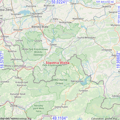
Sopotnia Wielka GPS coordinates[2]
49° 34' 6.708" North, 19° 16' 58.404" East
| Map corner | latitude | longitude |
|---|---|---|
| Upper-left | 50.02241°, | 18.57977° |
| Center: | 49.56853°, | 19.28289° |
| Lower-right: | 49.1104°, | 19.98602° |
| Map W x H: | 101.4×101.4 km | = 63×63mi |
| max Lat: | 54.83135° ⇑97.1% North |
| Sopotnia Wielka: | 49.56853° |
| min Lat: | ⇓2.9% South 49.21328° |
| min Long | Sopotnia Wielka | max Long |
| 14.20249° | 19.28289° | 24.03723° |
| W 45.4%⇐ | ⇒54.6% E |
Elevation
Elevation of Sopotnia Wielka is 738 m = 2421 ft, and this is 546.6 m = 1793 ft above average elevation for this country.
| Max E: |
974 m = 3196 ft | 0.2% |
| Sopotnia Wielka | 738 m 2421 ft | |
| Avg. | 191.4 m = 628 ft | |
Min E: |
-3 m = -10 ft | 99.8% |
See also: Poland elevation on elevation.city.
Geographical zone
Sopotnia Wielka is located in North temperate zone (between Tropic of Cancer and the Arctic Circle). Distance of this North polar circle is 1889.7 km =1174.2 mi to North.| Distance of | km | miles | from Sopotnia Wielka |
|---|---|---|---|
| North Pole | 4495.6 | 2793.4 | to North |
| Arctic Circle | 1889.7 | 1174.2 | to North |
| Tropic Cancer | 2905.6 | 1805.5 | to South |
| Equator | 5511.5 | 3424.7 | to South |


Nearby cities:
15 places around Sopotnia Wielka: (largest is in red/bold)
• Bystra
8.9 km =5.5 mi,  310°
310°
• Cisiec
13.1 km =8.1 mi,  281°
281°
• Cięcina
10.9 km =6.8 mi,  290°
290°
• Jeleśnia
8.8 km =5.5 mi,  21°
21°
• Juszczyna
8.2 km =5.1 mi,  326°
326°
• Korbielów
4.8 km =3 mi,  90°
90°
• Koszarawa
12 km =7.5 mi,  45°
45°
• Krzyżowa
5.2 km =3.2 mi,  59°
59°
• Przyborów
9.5 km =5.9 mi, 51°
• Przybędza
13.3 km =8.3 mi,  301°
301°
• Trzebinia
10.1 km =6.3 mi, 334°
• Wieprz
11.5 km =7.1 mi,  319°
319°
• Węgierska Górka
12.8 km =8 mi, 289°
• Świnna
10.2 km =6.3 mi,  348°
348°
• Żabnica
9.2 km =5.7 mi, 278°
Sources, notices
• [Note1] Compared only with cities in Poland existing in our database
• [Src1] Map data: © OpenStreetMap contributors (CC-BY-SA)
• [Src2] Other city data from geonames.org with taken over terms of usage.
• [Src3] Geographical zone / Annual Mean Temperature by Robert A. Rohde @ Wikipedia
