Łękawica geodata
Łękawica (Silesia) is a populated place; located in Poland in Europe/Warsaw (GMT+2) time zone. With population of 2,169 people, there are 1384 cities with bigger population in this country. Compared to other cities in Poland, 93.9% of cities are located further ↑North; 54.9% of cities are located further →East and 93.6% of cities have lower elevation than Łękawica. Note1


Łękawica GPS coordinates[2]
49° 43' 19.524" North, 19° 15' 53.856" East
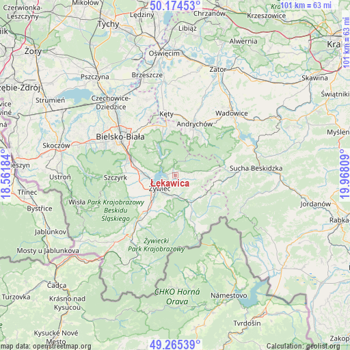
| Map corner | latitude | longitude |
|---|---|---|
| Upper-left | 50.17453°, | 18.56184° |
| Center: | 49.72209°, | 19.26496° |
| Lower-right: | 49.26539°, | 19.96809° |
| Map W x H: | 101.1×101.1 km | = 62.8×62.8mi |
| max Lat: | 54.83135° ⇑93.9% North |
| Łękawica: | 49.72209° |
| min Lat: | ⇓6.1% South 49.21328° |
| min Long | Łękawica | max Long |
| 14.20249° | 19.26496° | 24.03723° |
| W 45.1%⇐ | ⇒54.9% E |
Elevation
Elevation of Łękawica is 381 m = 1250 ft, and this is 189.6 m = 622 ft above average elevation for this country.
| Max E: |
974 m = 3196 ft | 6.4% |
| Łękawica | 381 m 1250 ft | |
| Avg. | 191.4 m = 628 ft | |
Min E: |
-3 m = -10 ft | 93.6% |
See also: Poland elevation on elevation.city.
Geographical zone
Łękawica is located in North temperate zone (between Tropic of Cancer and the Arctic Circle). Distance of this North polar circle is 1872.6 km =1163.6 mi to North.| Distance of | km | miles | from Łękawica |
|---|---|---|---|
| North Pole | 4478.5 | 2782.8 | to North |
| Arctic Circle | 1872.6 | 1163.6 | to North |
| Tropic Cancer | 2922.7 | 1816.1 | to South |
| Equator | 5528.6 | 3435.3 | to South |


Nearby cities:
15 places around Łękawica: (largest is in red/bold)
• Czernichów
5.4 km =3.4 mi,  312°
312°
• Gilowice
3.4 km =2.1 mi,  107°
107°
• Jeleśnia
9.9 km =6.2 mi,  153°
153°
• Międzybrodzie Bialskie
8.7 km =5.4 mi,  326°
326°
• Pewel Wielka
9.5 km =5.9 mi,  123°
123°
• Pewel Ślemieńska
6.2 km =3.9 mi,  125°
125°
• Pietrzykowice
8.1 km =5 mi,  249°
249°
• Targanice
10.2 km =6.3 mi,  24°
24°
• Tresna
4.4 km =2.7 mi,  292°
292°
• Trzebinia
8.5 km =5.3 mi,  200°
200°
• Zarzecze
6.5 km =4 mi,  267°
267°
• Łodygowice
9.1 km =5.7 mi,  275°
275°
• Ślemień
7.4 km =4.6 mi,  93°
93°
• Świnna
7.2 km =4.5 mi,  186°
186°
• Żywiec
6.6 km =4.1 mi,  231°
231°
Sources, notices
• [Note1] Compared only with cities in Poland existing in our database
• [Src1] Map data: © OpenStreetMap contributors (CC-BY-SA)
• [Src2] Other city data from geonames.org with taken over terms of usage.
• [Src3] Geographical zone / Annual Mean Temperature by Robert A. Rohde @ Wikipedia
