Kowale geodata
Kowale (Pomerania) is a populated place; located in Poland in Europe/Warsaw (GMT+2) time zone. With population of 1,972 people, there are 1510 cities with bigger population in this country. Compared to other cities in Poland, 97.7% of cities are located further ↓South; 67.2% of cities are located further →East and 86.1% of cities have higher elevation than Kowale. Note1


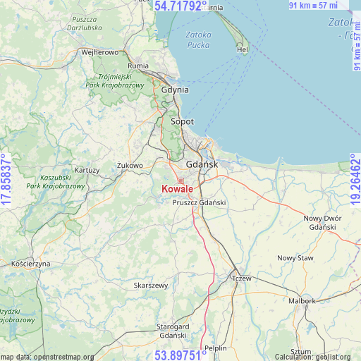
Kowale GPS coordinates[2]
54° 18' 35.136" North, 18° 33' 41.364" East
| Map corner | latitude | longitude |
|---|---|---|
| Upper-left | 54.71792°, | 17.85837° |
| Center: | 54.30976°, | 18.56149° |
| Lower-right: | 53.89751°, | 19.26462° |
| Map W x H: | 91.2×91.2 km | = 56.7×56.7mi |
| max Lat: | 54.83135° ⇑2.3% North |
| Kowale: | 54.30976° |
| min Lat: | ⇓97.7% South 49.21328° |
| min Long | Kowale | max Long |
| 14.20249° | 18.56149° | 24.03723° |
| W 32.8%⇐ | ⇒67.2% E |
Elevation
Elevation of Kowale is 87 m = 285 ft, and this is 104.4 m = 343 ft below average elevation for this country.
| Max E: |
974 m = 3196 ft | 86.1% |
| Avg. | 191.4 m = 628 ft | |
| Kowale | 87 m = 285 ft | |
Min E: |
-3 m = -10 ft | 13.9% |
See also: Poland elevation on elevation.city.
Geographical zone
Kowale is located in North temperate zone (between Tropic of Cancer and the Arctic Circle). Distance of this North polar circle is 1362.5 km =846.6 mi to North.| Distance of | km | miles | from Kowale |
|---|---|---|---|
| North Pole | 3968.4 | 2465.8 | to North |
| Arctic Circle | 1362.5 | 846.6 | to North |
| Tropic Cancer | 3432.8 | 2133 | to South |
| Equator | 6038.7 | 3752.3 | to South |


Nearby cities:
15 places around Kowale: (largest is in red/bold)
• Borkowo Łostowickie
2.5 km =1.6 mi,  118°
118°
• Cieplewo
10.3 km =6.4 mi,  144°
144°
• Gdańsk
7.2 km =4.5 mi,  49°
49°
• Juszkowo
6.4 km =4 mi,  155°
155°
• Kolbudy
7.6 km =4.7 mi,  234°
234°
• Lublewo Gdańskie
4.7 km =2.9 mi, 233°
• Pruszcz Gdański
7.2 km =4.5 mi, 137°
• Przejazdowo
12 km =7.5 mi,  80°
80°
• Pręgowo
8.1 km =5 mi,  220°
220°
• Pępowo
13.2 km =8.2 mi,  301°
301°
• Rokitnica
8.9 km =5.5 mi, 116°
• Rotmanka
4.8 km =3 mi,  145°
145°
• Rusocin
10 km =6.2 mi, 154°
• Straszyn
4.4 km =2.7 mi, 163°
• Łęgowo
10.7 km =6.6 mi, 150°
Sources, notices
• [Note1] Compared only with cities in Poland existing in our database
• [Src1] Map data: © OpenStreetMap contributors (CC-BY-SA)
• [Src2] Other city data from geonames.org with taken over terms of usage.
• [Src3] Geographical zone / Annual Mean Temperature by Robert A. Rohde @ Wikipedia
