Złotniki geodata
Złotniki (Lower Silesia) is a section of populated place; located in Poland in Europe/Warsaw (GMT+2) time zone. With population of 5,373 people, there are 651 cities with bigger population in this country. Compared to other cities in Poland, 51.1% of cities are located further ↑North; 86.2% of cities are located further →East and 72.6% of cities have higher elevation than Złotniki. Note1
Administrative division(s):
- Level 1: Lower Silesia
- Level 2: Wrocław
- Level 3: Wrocław
- Level 4: Leśnica


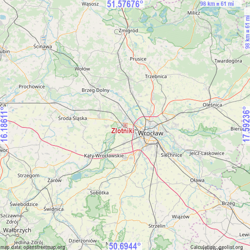
Złotniki GPS coordinates[2]
51° 8' 15.684" North, 16° 53' 21.228" East
| Map corner | latitude | longitude |
|---|---|---|
| Upper-left | 51.57676°, | 16.18611° |
| Center: | 51.13769°, | 16.88923° |
| Lower-right: | 50.6944°, | 17.59236° |
| Map W x H: | 98.1×98.1 km | = 61×61mi |
| max Lat: | 54.83135° ⇑51.1% North |
| Złotniki: | 51.13769° |
| min Lat: | ⇓48.9% South 49.21328° |
| min Long | Złotniki | max Long |
| 14.20249° | 16.88923° | 24.03723° |
| W 13.8%⇐ | ⇒86.2% E |
Elevation
Elevation of Złotniki is 116 m = 381 ft, and this is 75.4 m = 247 ft below average elevation for this country.
| Max E: |
974 m = 3196 ft | 72.6% |
| Avg. | 191.4 m = 628 ft | |
| Złotniki | 116 m = 381 ft | |
Min E: |
-3 m = -10 ft | 27.4% |
See also: Poland elevation on elevation.city.
Geographical zone
Złotniki is located in North temperate zone (between Tropic of Cancer and the Arctic Circle). Distance of this North polar circle is 1715.2 km =1065.8 mi to North.| Distance of | km | miles | from Złotniki |
|---|---|---|---|
| North Pole | 4321.1 | 2685 | to North |
| Arctic Circle | 1715.2 | 1065.8 | to North |
| Tropic Cancer | 3080.1 | 1913.9 | to South |
| Equator | 5686 | 3533.1 | to South |


Nearby cities:
15 places around Złotniki: (largest is in red/bold)
• Gądów Mały
7.1 km =4.4 mi,  107°
107°
• Jarnołtów-Jerzmanowo
2.4 km =1.5 mi,  221°
221°
• Kozanów
5.6 km =3.5 mi,  82°
82°
• Leśnica-Ratyń-Pustki
2.9 km =1.8 mi,  279°
279°
• Lutynia
7.3 km =4.5 mi,  268°
268°
• Marszowice
3.8 km =2.4 mi,  354°
354°
• Maślice Małe
3.9 km =2.4 mi,  70°
70°
• Maślice Wielkie
3.9 km =2.4 mi,  43°
43°
• Nowe Żerniki-Kolonie Żernickie
2.4 km =1.5 mi,  96°
96°
• Osiedle Kosmonautów
5.2 km =3.2 mi, 102°
• Pilczyce
4.8 km =3 mi,  90°
90°
• Pracze Odrzańskie-Janówek
5.7 km =3.5 mi,  13°
13°
• Smolec
7.2 km =4.5 mi,  183°
183°
• Stabłowice
1.9 km =1.2 mi,  23°
23°
• Strachowice-Osiniec
3.5 km =2.2 mi, 178°
Sources, notices
• [Note1] Compared only with cities in Poland existing in our database
• [Src1] Map data: © OpenStreetMap contributors (CC-BY-SA)
• [Src2] Other city data from geonames.org with taken over terms of usage.
• [Src3] Geographical zone / Annual Mean Temperature by Robert A. Rohde @ Wikipedia
