Jarnołtów-Jerzmanowo geodata
Jarnołtów-Jerzmanowo (Lower Silesia) is a section of populated place; located in Poland in Europe/Warsaw (GMT+2) time zone. With population of 1,357 people, there are 2017 cities with bigger population in this country. Compared to other cities in Poland, 51.7% of cities are located further ↑North; 86.5% of cities are located further →East and 71.1% of cities have higher elevation than Jarnołtów-Jerzmanowo. Note1
Administrative division(s):
- Level 1: Lower Silesia
- Level 2: Wrocław
- Level 3: Wrocław
- Level 4: Jerzmanowo - Jarnołtów - Strachowice - Osiniec


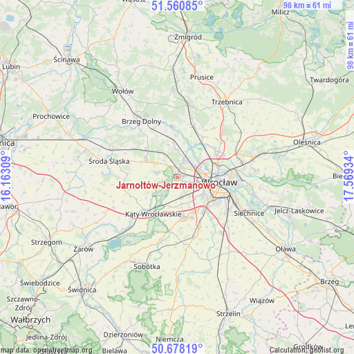
Jarnołtów-Jerzmanowo GPS coordinates[2]
51° 7' 17.868" North, 16° 51' 58.356" East
| Map corner | latitude | longitude |
|---|---|---|
| Upper-left | 51.56085°, | 16.16309° |
| Center: | 51.12163°, | 16.86621° |
| Lower-right: | 50.67819°, | 17.56934° |
| Map W x H: | 98.1×98.1 km | = 61×61mi |
| max Lat: | 54.83135° ⇑51.7% North |
| Jarnołtów-Jerzmanowo: | 51.12163° |
| min Lat: | ⇓48.3% South 49.21328° |
| min Long | Jarnołtów-Jer | max Long |
| 14.20249° | 16.86621° | 24.03723° |
| W 13.5%⇐ | ⇒86.5% E |
Elevation
Elevation of Jarnołtów-Jerzmanowo is 119 m = 390 ft, and this is 72.4 m = 238 ft below average elevation for this country.
| Max E: |
974 m = 3196 ft | 71.1% |
| Avg. | 191.4 m = 628 ft | |
| Jarnołtów-Jerzmanowo | 119 m = 390 ft | |
Min E: |
-3 m = -10 ft | 28.9% |
See also: Poland elevation on elevation.city.
Geographical zone
Jarnołtów-Jerzmanowo is located in North temperate zone (between Tropic of Cancer and the Arctic Circle). Distance of this North polar circle is 1717 km =1066.9 mi to North.| Distance of | km | miles | from Jarnołtów-Jerzmanowo |
|---|---|---|---|
| North Pole | 4322.9 | 2686.1 | to North |
| Arctic Circle | 1717 | 1066.9 | to North |
| Tropic Cancer | 3078.3 | 1912.8 | to South |
| Equator | 5684.2 | 3532 | to South |


Nearby cities:
15 places around Jarnołtów-Jerzmanowo: (largest is in red/bold)
• Kozanów
7.6 km =4.7 mi,  70°
70°
• Leśnica-Ratyń-Pustki
2.6 km =1.6 mi,  330°
330°
• Lutynia
5.9 km =3.7 mi,  284°
284°
• Marszowice
5.7 km =3.5 mi,  12°
12°
• Małkowice
5.8 km =3.6 mi,  211°
211°
• Maślice Małe
6.1 km =3.8 mi,  59°
59°
• Maślice Wielkie
6.3 km =3.9 mi,  43°
43°
• Nowe Żerniki-Kolonie Żernickie
4.2 km =2.6 mi, 69°
• Osiedle Kosmonautów
6.7 km =4.2 mi,  84°
84°
• Pietrzykowice
7.4 km =4.6 mi,  172°
172°
• Pilczyce
6.6 km =4.1 mi, 74°
• Smolec
5.5 km =3.4 mi, 168°
• Stabłowice
4.3 km =2.7 mi,  33°
33°
• Strachowice-Osiniec
2.4 km =1.5 mi,  134°
134°
• Złotniki
2.4 km =1.5 mi, 41°
Sources, notices
• [Note1] Compared only with cities in Poland existing in our database
• [Src1] Map data: © OpenStreetMap contributors (CC-BY-SA)
• [Src2] Other city data from geonames.org with taken over terms of usage.
• [Src3] Geographical zone / Annual Mean Temperature by Robert A. Rohde @ Wikipedia
