La Alianza geodata
La Alianza (Arecibo) is a populated place; located in Puerto Rico in America/Puerto_Rico (GMT-4) time zone. With population of 2,139 people, there are 131 cities with bigger population in this country. Compared to other cities in Puerto Rico, 76.9% of cities are located further ↓South; 68.9% of cities are located further →East and 82.7% of cities have lower elevation than La Alianza. Note1


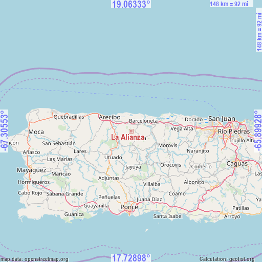
La Alianza GPS coordinates[2]
18° 23' 50.82" North, 66° 36' 8.64" West
| Map corner | latitude | longitude |
|---|---|---|
| Upper-left | 19.06333°, | -67.30553° |
| Center: | 18.39745°, | -66.6024° |
| Lower-right: | 17.72898°, | -65.89928° |
| Map W x H: | 148.4×148.4 km | = 92.2×92.2mi |
| max Lat: | 18.50078° ⇑23.1% North |
| La Alianza: | 18.39745° |
| min Lat: | ⇓76.9% South 17.95358° |
| min Long | La Alianza | max Long |
| -67.2499° | -66.6024° | -65.30099° |
| W 31.1%⇐ | ⇒68.9% E |
Elevation
Elevation of La Alianza is 170 m = 558 ft, and this is 69.5 m = 228 ft above average elevation for this country.
| Max E: |
655 m = 2149 ft | 17.3% |
| La Alianza | 170 m 558 ft | |
| Avg. | 100.5 m = 330 ft | |
Min E: |
1 m = 3 ft | 82.7% |
See also: Puerto Rico elevation on elevation.city.
Geographical zone
La Alianza is located in North Torrid zone (between Equator and Tropic of Cancer). Distance of this Northern Tropic circle is 560.3 km =348.2 mi to North.| Distance of | km | miles | from La Alianza |
|---|---|---|---|
| North Pole | 7961.5 | 4947 | to North |
| Arctic Circle | 5355.6 | 3327.8 | to North |
| Tropic Cancer | 560.3 | 348.2 | to North |
| Equator | 2045.6 | 1271.1 | to South |


Nearby cities:
15 places around La Alianza: (largest is in red/bold)
• Animas
6.3 km =3.9 mi,  327°
327°
• Arecibo
14.6 km =9.1 mi,  304°
304°
• Bajadero
9.1 km =5.7 mi,  290°
290°
• Barceloneta
9 km =5.6 mi,  48°
48°
• Bufalo
3.9 km =2.4 mi, 53°
• Estancias de Florida
4.9 km =3 mi,  134°
134°
• Florida
5.8 km =3.6 mi, 131°
• Garrochales
7.3 km =4.5 mi,  31°
31°
• Imbery
6.9 km =4.3 mi, 50°
• La Luisa
11.3 km =7 mi,  59°
59°
• Manatí
12.1 km =7.5 mi,  74°
74°
• Pajonal
5.2 km =3.2 mi,  109°
109°
• Sabana Hoyos
4.2 km =2.6 mi,  343°
343°
• Tiburones
4.4 km =2.7 mi, 31°
• Tierras Nuevas Poniente
14 km =8.7 mi, 59°
Sources, notices
• [Note1] Compared only with cities in Puerto Rico existing in our database
• [Src1] Map data: © OpenStreetMap contributors (CC-BY-SA)
• [Src2] Other city data from geonames.org with taken over terms of usage.
• [Src3] Geographical zone / Annual Mean Temperature by Robert A. Rohde @ Wikipedia
