Bajadero geodata
Bajadero (Arecibo) is a populated place; located in Puerto Rico in America/Puerto_Rico (GMT-4) time zone. With population of 3,877 people, there are 85 cities with bigger population in this country. Compared to other cities in Puerto Rico, 81.3% of cities are located further ↓South; 71.1% of cities are located further →East and 67.1% of cities have higher elevation than Bajadero. Note1


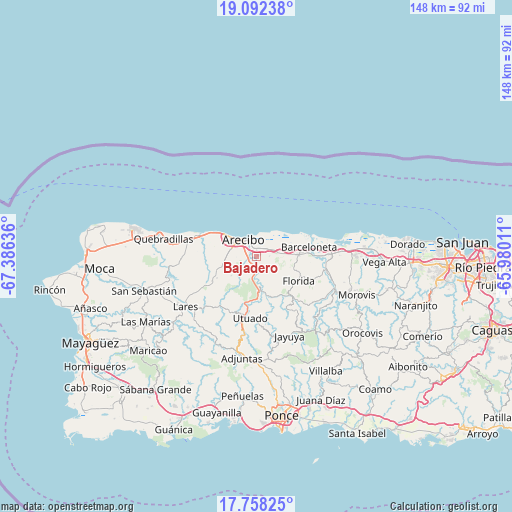
Bajadero GPS coordinates[2]
18° 25' 35.796" North, 66° 40' 59.628" West
| Map corner | latitude | longitude |
|---|---|---|
| Upper-left | 19.09238°, | -67.38636° |
| Center: | 18.42661°, | -66.68323° |
| Lower-right: | 17.75825°, | -65.98011° |
| Map W x H: | 148.3×148.3 km | = 92.1×92.1mi |
| max Lat: | 18.50078° ⇑18.7% North |
| Bajadero: | 18.42661° |
| min Lat: | ⇓81.3% South 17.95358° |
| min Long | Bajadero | max Long |
| -67.2499° | -66.68323° | -65.30099° |
| W 28.9%⇐ | ⇒71.1% E |
Elevation
Elevation of Bajadero is 25 m = 82 ft, and this is 75.5 m = 248 ft below average elevation for this country.
| Max E: |
655 m = 2149 ft | 67.1% |
| Avg. | 100.5 m = 330 ft | |
| Bajadero | 25 m = 82 ft | |
Min E: |
1 m = 3 ft | 32.9% |
See also: Puerto Rico elevation on elevation.city.
Geographical zone
Bajadero is located in North Torrid zone (between Equator and Tropic of Cancer). Distance of this Northern Tropic circle is 557.1 km =346.2 mi to North.| Distance of | km | miles | from Bajadero |
|---|---|---|---|
| North Pole | 7958.2 | 4945 | to North |
| Arctic Circle | 5352.3 | 3325.8 | to North |
| Tropic Cancer | 557.1 | 346.2 | to North |
| Equator | 2048.8 | 1273.1 | to South |


Nearby cities:
15 places around Bajadero: (largest is in red/bold)
• Animas
5.5 km =3.4 mi,  67°
67°
• Arecibo
6.1 km =3.8 mi,  326°
326°
• Bufalo
11.6 km =7.2 mi,  94°
94°
• Carrizales
12.8 km =8 mi,  298°
298°
• Corcovado
10.4 km =6.5 mi,  289°
289°
• Estancias de Florida
13.7 km =8.5 mi,  119°
119°
• Florida
14.7 km =9.1 mi, 119°
• Garrochales
12.7 km =7.9 mi,  76°
76°
• Imbery
13.8 km =8.6 mi, 85°
• La Alianza
9.1 km =5.7 mi,  110°
110°
• Pajonal
14.3 km =8.9 mi, 110°
• Rafael Capo
10.7 km =6.6 mi,  258°
258°
• Rafael Gonzalez
10.9 km =6.8 mi,  270°
270°
• Sabana Hoyos
7.4 km =4.6 mi, 83°
• Tiburones
10.8 km =6.7 mi, 87°
Sources, notices
• [Note1] Compared only with cities in Puerto Rico existing in our database
• [Src1] Map data: © OpenStreetMap contributors (CC-BY-SA)
• [Src2] Other city data from geonames.org with taken over terms of usage.
• [Src3] Geographical zone / Annual Mean Temperature by Robert A. Rohde @ Wikipedia
