‘Abasān al Jadīdah geodata
‘Abasān al Jadīdah is a populated place; located in Palestinian Territory in Asia/Gaza (GMT+3) time zone. With population of 5,984 people, there are 96 cities with bigger population in this country. Compared to other cities in Palestinian Territory, 98.2% of cities are located further ↑North; 97.7% of cities are located further →East and 91.6% of cities have higher elevation than ‘Abasān al Jadīdah. Note1


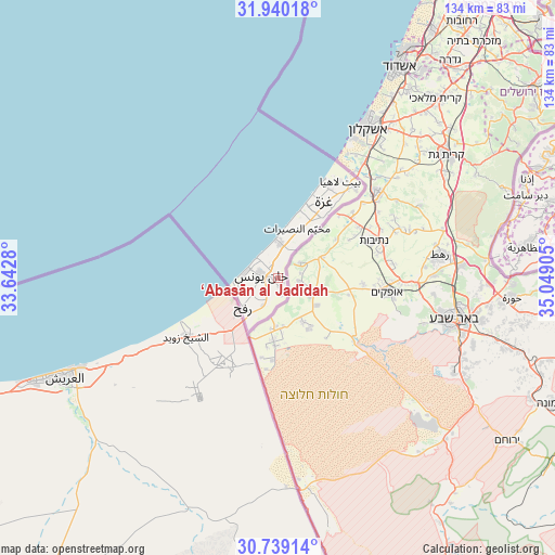
‘Abasān al Jadīdah GPS coordinates[2]
31° 20' 29.688" North, 34° 20' 45.312" East
| Map corner | latitude | longitude |
|---|---|---|
| Upper-left | 31.94018°, | 33.6428° |
| Center: | 31.34158°, | 34.34592° |
| Lower-right: | 30.73914°, | 35.04905° |
| Map W x H: | 133.5×133.5 km | = 83×83mi |
| max Lat: | 32.54346° ⇑98.2% North |
| ‘Abasān al Jadīdah: | 31.34158° |
| min Lat: | ⇓1.8% South 31.25997° |
| min Long | ‘Abasān al J | max Long |
| 34.24357° | 34.34592° | 35.53898° |
| W 2.3%⇐ | ⇒97.7% E |
Elevation
Elevation of ‘Abasān al Jadīdah is 82 m = 269 ft, and this is 391.3 m = 1284 ft below average elevation for this country.
| Max E: |
999 m = 3278 ft | 91.6% |
| Avg. | 473.3 m = 1553 ft | |
| ‘Abasān al Jadīdah | 82 m = 269 ft | |
Min E: |
-269 m = -883 ft | 8.4% |
See also: Palestinian Territory elevation on elevation.city.
Geographical zone
‘Abasān al Jadīdah is located in North temperate zone (between Tropic of Cancer and the Arctic Circle). Distance of this Northern Tropic circle is 878.9 km =546.1 mi to South.| Distance of | km | miles | from ‘Abasān al Jadīdah |
|---|---|---|---|
| North Pole | 6522.2 | 4052.7 | to North |
| Arctic Circle | 3916.3 | 2433.5 | to North |
| Tropic Cancer | 878.9 | 546.1 | to South |
| Equator | 3484.9 | 2165.4 | to South |


Nearby cities:
15 places around ‘Abasān al Jadīdah: (largest is in red/bold)
• Al Burayj
12.2 km =7.6 mi,  26°
26°
• Al Fukhkhārī
5.6 km =3.5 mi,  195°
195°
• Al Muşaddar
8.2 km =5.1 mi,  21°
21°
• Al Qarārah
3.6 km =2.2 mi,  352°
352°
• An Naşr
7.9 km =4.9 mi,  211°
211°
• An Nuşayrāt
12.7 km =7.9 mi, 20°
• Az Zuwāydah
11.4 km =7.1 mi, 16°
• Banī Suhaylā
2.2 km =1.4 mi,  275°
275°
• Dayr al Balaḩ
8.5 km =5.3 mi,  2°
2°
• Khuzā‘ah
4.1 km =2.5 mi,  159°
159°
• Khān Yūnis
3.8 km =2.4 mi,  267°
267°
• Rafaḩ
10.9 km =6.8 mi,  243°
243°
• Shūkat aş Şūfī
10.9 km =6.8 mi, 213°
• Wādī as Salqā
6.6 km =4.1 mi, 353°
• ‘Abasān al Kabīrah
2.6 km =1.6 mi,  192°
192°
Sources, notices
• [Note1] Compared only with cities in Palestinian Territory existing in our database
• [Src1] Map data: © OpenStreetMap contributors (CC-BY-SA)
• [Src2] Other city data from geonames.org with taken over terms of usage.
• [Src3] Geographical zone / Annual Mean Temperature by Robert A. Rohde @ Wikipedia
