‘Ayn al Bayḑā geodata
‘Ayn al Bayḑā is a populated place; located in Palestinian Territory in Asia/Hebron (GMT+3) time zone. With population of 1,145 people, there are 311 cities with bigger population in this country. Compared to other cities in Palestinian Territory, 87.5% of cities are located further ↓South; 99.5% of cities are located further ←West and 98.5% of cities have higher elevation than ‘Ayn al Bayḑā. Note1


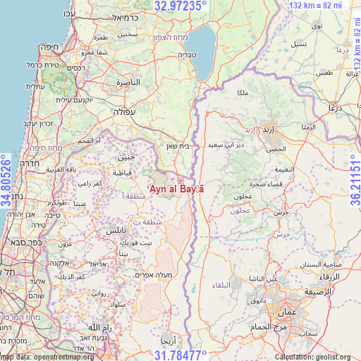
‘Ayn al Bayḑā GPS coordinates[2]
32° 22' 49.836" North, 35° 30' 30.168" East
| Map corner | latitude | longitude |
|---|---|---|
| Upper-left | 32.97235°, | 34.80526° |
| Center: | 32.38051°, | 35.50838° |
| Lower-right: | 31.78477°, | 36.21151° |
| Map W x H: | 132×132 km | = 82×82mi |
| max Lat: | 32.54346° ⇑12.5% North |
| ‘Ayn al Bayḑā: | 32.38051° |
| min Lat: | ⇓87.5% South 31.25997° |
| min Long | ‘Ayn al Bay� | max Long |
| 34.24357° | 35.50838° | 35.53898° |
| W 99.5%⇐ | ⇒0.5% E |
Elevation
Elevation of ‘Ayn al Bayḑā is -171 m = -561 ft, and this is 644.3 m = 2114 ft below average elevation for this country.
| Max E: |
999 m = 3278 ft | 98.5% |
| Avg. | 473.3 m = 1553 ft | |
| ‘Ayn al Bayḑā | -171 m = -561 ft | |
Min E: |
-269 m = -883 ft | 1.5% |
See also: Palestinian Territory elevation on elevation.city.
Geographical zone
‘Ayn al Bayḑā is located in North temperate zone (between Tropic of Cancer and the Arctic Circle). Distance of this Northern Tropic circle is 994.5 km =618 mi to South.| Distance of | km | miles | from ‘Ayn al Bayḑā |
|---|---|---|---|
| North Pole | 6406.7 | 3980.9 | to North |
| Arctic Circle | 3800.8 | 2361.7 | to North |
| Tropic Cancer | 994.5 | 618 | to South |
| Equator | 3600.4 | 2237.2 | to South |


Nearby cities:
15 places around ‘Ayn al Bayḑā: (largest is in red/bold)
• Al Mughayyir
12.5 km =7.8 mi,  291°
291°
• Ath Thaghrah
12.5 km =7.8 mi,  243°
243°
• Az Zabābidah
17.3 km =10.7 mi,  272°
272°
• Bardalah
2.7 km =1.7 mi,  284°
284°
• Bayt Qād
17.4 km =10.8 mi,  304°
304°
• Dayr Abū Ḑa‘īf
16.1 km =10 mi, 301°
• Faqqū‘ah
15.8 km =9.8 mi,  320°
320°
• Jalbūn
12.4 km =7.7 mi, 315°
• Jalqamūs
14.4 km =8.9 mi, 289°
• Rābā
11.8 km =7.3 mi, 273°
• Tayāsīr
11.5 km =7.1 mi,  247°
247°
• Umm at Tūt
16.5 km =10.3 mi, 290°
• Şīr
18.2 km =11.3 mi,  264°
264°
• Ţammūn
15.9 km =9.9 mi,  227°
227°
• Ţūbās
14.6 km =9.1 mi, 243°
Sources, notices
• [Note1] Compared only with cities in Palestinian Territory existing in our database
• [Src1] Map data: © OpenStreetMap contributors (CC-BY-SA)
• [Src2] Other city data from geonames.org with taken over terms of usage.
• [Src3] Geographical zone / Annual Mean Temperature by Robert A. Rohde @ Wikipedia
