Qilā‘ Zaytā geodata
Qilā‘ Zaytā (West Bank) is a populated place; located in Palestinian Territory in Asia/Hebron (GMT+3) time zone. With population of 889 people, there are 338 cities with bigger population in this country. Compared to other cities in Palestinian Territory, 83% of cities are located further ↑North; 63.1% of cities are located further →East and 98.7% of cities have lower elevation than Qilā‘ Zaytā. Note1


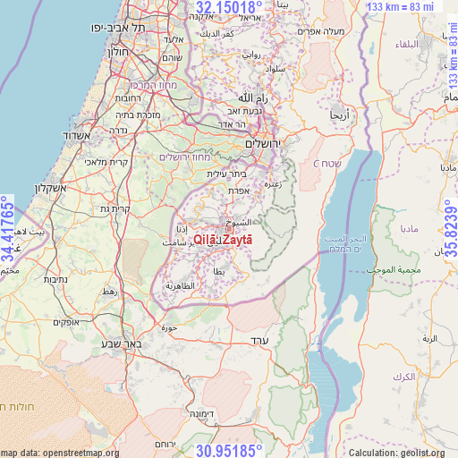
Qilā‘ Zaytā GPS coordinates[2]
31° 33' 10.584" North, 35° 7' 14.772" East
| Map corner | latitude | longitude |
|---|---|---|
| Upper-left | 32.15018°, | 34.41765° |
| Center: | 31.55294°, | 35.12077° |
| Lower-right: | 30.95185°, | 35.8239° |
| Map W x H: | 133.2×133.2 km | = 82.8×82.8mi |
| max Lat: | 32.54346° ⇑83% North |
| Qilā‘ Zaytā: | 31.55294° |
| min Lat: | ⇓17% South 31.25997° |
| min Long | Qilā‘ Zaytā | max Long |
| 34.24357° | 35.12077° | 35.53898° |
| W 36.9%⇐ | ⇒63.1% E |
Elevation
Elevation of Qilā‘ Zaytā is 963 m = 3159 ft, and this is 489.7 m = 1607 ft above average elevation for this country.
| Max E: |
999 m = 3278 ft | 1.3% |
| Qilā‘ Zaytā | 963 m 3159 ft | |
| Avg. | 473.3 m = 1553 ft | |
Min E: |
-269 m = -883 ft | 98.7% |
See also: Palestinian Territory elevation on elevation.city.
Geographical zone
Qilā‘ Zaytā is located in North temperate zone (between Tropic of Cancer and the Arctic Circle). Distance of this Northern Tropic circle is 902.4 km =560.7 mi to South.| Distance of | km | miles | from Qilā‘ Zaytā |
|---|---|---|---|
| North Pole | 6498.7 | 4038.1 | to North |
| Arctic Circle | 3892.8 | 2418.9 | to North |
| Tropic Cancer | 902.4 | 560.7 | to South |
| Equator | 3508.4 | 2180 | to South |


Nearby cities:
15 places around Qilā‘ Zaytā: (largest is in red/bold)
• Al Buq‘ah
2.4 km =1.5 mi,  120°
120°
• Al Buwayrah
7.2 km =4.5 mi,  183°
183°
• Ash Shuyūkh
3.8 km =2.4 mi,  60°
60°
• Banī Na‘īm
5.8 km =3.6 mi,  135°
135°
• Bayt Fajjār
8.6 km =5.3 mi,  21°
21°
• Bayt Kāḩil
5.6 km =3.5 mi,  289°
289°
• Bayt Ūmmar
8 km =5 mi,  348°
348°
• Bayt ‘Īnūn
0.7 km =0.4 mi,  28°
28°
• Hebron
3.7 km =2.3 mi,  224°
224°
• Khallat ad Dār
6.2 km =3.9 mi,  186°
186°
• Qalqas
7.2 km =4.5 mi,  199°
199°
• Sa‘īr
3.4 km =2.1 mi, 32°
• Shuyūkh al ‘Arrūb
7.5 km =4.7 mi, 16°
• Taffūḩ
6.9 km =4.3 mi,  256°
256°
• Ḩalḩūl
3.5 km =2.2 mi,  329°
329°
Sources, notices
• [Note1] Compared only with cities in Palestinian Territory existing in our database
• [Src1] Map data: © OpenStreetMap contributors (CC-BY-SA)
• [Src2] Other city data from geonames.org with taken over terms of usage.
• [Src3] Geographical zone / Annual Mean Temperature by Robert A. Rohde @ Wikipedia
