Ḩuwwārah geodata
Ḩuwwārah (West Bank) is a populated place; located in Palestinian Territory in Asia/Hebron (GMT+3) time zone. With population of 5,633 people, there are 102 cities with bigger population in this country. Compared to other cities in Palestinian Territory, 63.6% of cities are located further ↓South; 77.6% of cities are located further ←West and 55.2% of cities have lower elevation than Ḩuwwārah. Note1


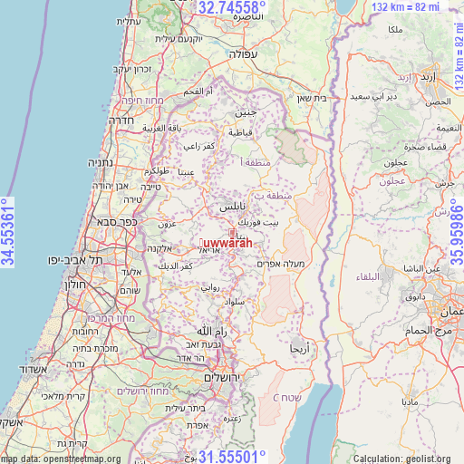
Ḩuwwārah GPS coordinates[2]
32° 9' 8.064" North, 35° 15' 24.228" East
| Map corner | latitude | longitude |
|---|---|---|
| Upper-left | 32.74558°, | 34.55361° |
| Center: | 32.15224°, | 35.25673° |
| Lower-right: | 31.55501°, | 35.95986° |
| Map W x H: | 132.4×132.4 km | = 82.3×82.3mi |
| max Lat: | 32.54346° ⇑36.4% North |
| Ḩuwwārah: | 32.15224° |
| min Lat: | ⇓63.6% South 31.25997° |
| min Long | Ḩuwwārah | max Long |
| 34.24357° | 35.25673° | 35.53898° |
| W 77.6%⇐ | ⇒22.4% E |
Elevation
Elevation of Ḩuwwārah is 522 m = 1713 ft, and this is 48.7 m = 160 ft above average elevation for this country.
| Max E: |
999 m = 3278 ft | 44.8% |
| Ḩuwwārah | 522 m 1713 ft | |
| Avg. | 473.3 m = 1553 ft | |
Min E: |
-269 m = -883 ft | 55.2% |
See also: Palestinian Territory elevation on elevation.city.
Geographical zone
Ḩuwwārah is located in North temperate zone (between Tropic of Cancer and the Arctic Circle). Distance of this Northern Tropic circle is 969.1 km =602.2 mi to South.| Distance of | km | miles | from Ḩuwwārah |
|---|---|---|---|
| North Pole | 6432.1 | 3996.7 | to North |
| Arctic Circle | 3826.2 | 2377.5 | to North |
| Tropic Cancer | 969.1 | 602.2 | to South |
| Equator | 3575 | 2221.4 | to South |


Nearby cities:
15 places around Ḩuwwārah: (largest is in red/bold)
• Baytā al Fawqā
3.1 km =1.9 mi,  110°
110°
• Būrīn
3.6 km =2.2 mi,  350°
350°
• Jammā‘īn
5.5 km =3.4 mi,  245°
245°
• Kafr Qallīl
5.2 km =3.2 mi,  28°
28°
• Mādamā
4.4 km =2.7 mi,  327°
327°
• Rūjayb
5.5 km =3.4 mi,  38°
38°
• Usarin
5.9 km =3.7 mi,  121°
121°
• Yatmā
5 km =3.1 mi,  166°
166°
• Yāsūf
5.2 km =3.2 mi,  200°
200°
• Ūdalah
1.9 km =1.2 mi,  85°
85°
• ‘Awartā
2.7 km =1.7 mi,  68°
68°
• ‘Aynabūs
1.2 km =0.7 mi,  242°
242°
• ‘Aşīrah al Qiblīyah
4.8 km =3 mi,  307°
307°
• ‘Irāq Būrīn
5.6 km =3.5 mi, 345°
• ‘Ūrīf
3.3 km =2.1 mi,  283°
283°
Sources, notices
• [Note1] Compared only with cities in Palestinian Territory existing in our database
• [Src1] Map data: © OpenStreetMap contributors (CC-BY-SA)
• [Src2] Other city data from geonames.org with taken over terms of usage.
• [Src3] Geographical zone / Annual Mean Temperature by Robert A. Rohde @ Wikipedia
