‘Aşīrah al Qiblīyah geodata
‘Aşīrah al Qiblīyah (West Bank) is a populated place; located in Palestinian Territory in Asia/Hebron (GMT+3) time zone. With population of 2,341 people, there are 212 cities with bigger population in this country. Compared to other cities in Palestinian Territory, 66.4% of cities are located further ↓South; 65.9% of cities are located further ←West and 62.6% of cities have lower elevation than ‘Aşīrah al Qiblīyah. Note1


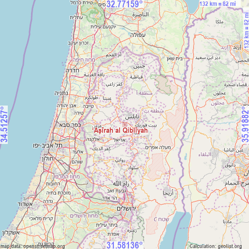
‘Aşīrah al Qiblīyah GPS coordinates[2]
32° 10' 42.312" North, 35° 12' 56.484" East
| Map corner | latitude | longitude |
|---|---|---|
| Upper-left | 32.77159°, | 34.51257° |
| Center: | 32.17842°, | 35.21569° |
| Lower-right: | 31.58136°, | 35.91882° |
| Map W x H: | 132.3×132.3 km | = 82.2×82.2mi |
| max Lat: | 32.54346° ⇑33.6% North |
| ‘Aşīrah al Qiblīyah: | 32.17842° |
| min Lat: | ⇓66.4% South 31.25997° |
| min Long | ‘Aşīrah al | max Long |
| 34.24357° | 35.21569° | 35.53898° |
| W 65.9%⇐ | ⇒34.1% E |
Elevation
Elevation of ‘Aşīrah al Qiblīyah is 579 m = 1900 ft, and this is 105.7 m = 347 ft above average elevation for this country.
| Max E: |
999 m = 3278 ft | 37.4% |
| ‘Aşīrah al Qiblīyah | 579 m 1900 ft | |
| Avg. | 473.3 m = 1553 ft | |
Min E: |
-269 m = -883 ft | 62.6% |
See also: Palestinian Territory elevation on elevation.city.
Geographical zone
‘Aşīrah al Qiblīyah is located in North temperate zone (between Tropic of Cancer and the Arctic Circle). Distance of this Northern Tropic circle is 972 km =604 mi to South.| Distance of | km | miles | from ‘Aşīrah al Qiblīyah |
|---|---|---|---|
| North Pole | 6429.2 | 3994.9 | to North |
| Arctic Circle | 3823.3 | 2375.7 | to North |
| Tropic Cancer | 972 | 604 | to South |
| Equator | 3577.9 | 2223.2 | to South |


Nearby cities:
15 places around ‘Aşīrah al Qiblīyah: (largest is in red/bold)
• Bayt Wazan
5.9 km =3.7 mi,  0°
0°
• Būrīn
3.3 km =2.1 mi,  78°
78°
• Far‘atā
4.9 km =3 mi,  286°
286°
• Immātīn
5.6 km =3.5 mi, 285°
• Jammā‘īn
5.3 km =3.3 mi,  191°
191°
• Jīt
5.8 km =3.6 mi,  313°
313°
• Mādamā
1.7 km =1.1 mi,  60°
60°
• Nablus
6 km =3.7 mi,  37°
37°
• Till
2.5 km =1.6 mi,  354°
354°
• Zaytā Jammā‘īn
5.4 km =3.4 mi,  211°
211°
• Şarrah
4.2 km =2.6 mi,  326°
326°
• Ḩuwwārah
4.8 km =3 mi,  127°
127°
• ‘Aynabūs
4.5 km =2.8 mi,  141°
141°
• ‘Irāq Būrīn
3.5 km =2.2 mi, 44°
• ‘Ūrīf
2.2 km =1.4 mi,  163°
163°
Sources, notices
• [Note1] Compared only with cities in Palestinian Territory existing in our database
• [Src1] Map data: © OpenStreetMap contributors (CC-BY-SA)
• [Src2] Other city data from geonames.org with taken over terms of usage.
• [Src3] Geographical zone / Annual Mean Temperature by Robert A. Rohde @ Wikipedia
