Al Fandaqūmīyah geodata
Al Fandaqūmīyah (West Bank) is a populated place; located in Palestinian Territory in Asia/Hebron (GMT+3) time zone. With population of 3,266 people, there are 163 cities with bigger population in this country. Compared to other cities in Palestinian Territory, 81.9% of cities are located further ↓South; 63.1% of cities are located further ←West and 53.7% of cities have higher elevation than Al Fandaqūmīyah. Note1


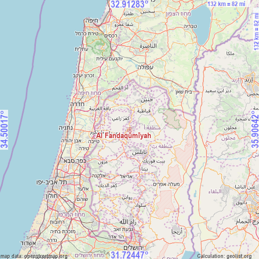
Al Fandaqūmīyah GPS coordinates[2]
32° 19' 14.16" North, 35° 12' 11.844" East
| Map corner | latitude | longitude |
|---|---|---|
| Upper-left | 32.91283°, | 34.50017° |
| Center: | 32.3206°, | 35.20329° |
| Lower-right: | 31.72447°, | 35.90642° |
| Map W x H: | 132.1×132.1 km | = 82.1×82.1mi |
| max Lat: | 32.54346° ⇑18.1% North |
| Al Fandaqūmīyah: | 32.3206° |
| min Lat: | ⇓81.9% South 31.25997° |
| min Long | Al Fandaqūmīy | max Long |
| 34.24357° | 35.20329° | 35.53898° |
| W 63.1%⇐ | ⇒36.9% E |
Elevation
Elevation of Al Fandaqūmīyah is 455 m = 1493 ft, and this is 18.3 m = 60 ft below average elevation for this country.
| Max E: |
999 m = 3278 ft | 53.7% |
| Avg. | 473.3 m = 1553 ft | |
| Al Fandaqūmīyah | 455 m = 1493 ft | |
Min E: |
-269 m = -883 ft | 46.3% |
See also: Palestinian Territory elevation on elevation.city.
Geographical zone
Al Fandaqūmīyah is located in North temperate zone (between Tropic of Cancer and the Arctic Circle). Distance of this Northern Tropic circle is 987.8 km =613.8 mi to South.| Distance of | km | miles | from Al Fandaqūmīyah |
|---|---|---|---|
| North Pole | 6413.3 | 3985 | to North |
| Arctic Circle | 3807.5 | 2365.9 | to North |
| Tropic Cancer | 987.8 | 613.8 | to South |
| Equator | 3593.7 | 2233 | to South |


Nearby cities:
15 places around Al Fandaqūmīyah: (largest is in red/bold)
• Al ‘Aţţārah
3.8 km =2.4 mi,  278°
278°
• An Nāqūrah
6.2 km =3.9 mi,  181°
181°
• Ar Rāmah
5.2 km =3.2 mi,  324°
324°
• Az Zāwiyah
6.7 km =4.2 mi,  23°
23°
• Bayt Imrīn
3.3 km =2.1 mi,  158°
158°
• Bazzāryah
3.8 km =2.4 mi,  248°
248°
• Burqah
2.3 km =1.4 mi,  205°
205°
• Jaba‘
1.7 km =1.1 mi,  77°
77°
• Maythalūn
7.3 km =4.5 mi,  65°
65°
• Rāmīn
6.4 km =4 mi,  232°
232°
• Sabasţīyah
5 km =3.1 mi, 184°
• Sīlat az̧ Z̧ahr
1.8 km =1.1 mi,  265°
265°
• Şānūr
5.6 km =3.5 mi,  45°
45°
• ‘Ajjah
4.5 km =2.8 mi,  351°
351°
• ‘Anzah
4.6 km =2.9 mi, 20°
Sources, notices
• [Note1] Compared only with cities in Palestinian Territory existing in our database
• [Src1] Map data: © OpenStreetMap contributors (CC-BY-SA)
• [Src2] Other city data from geonames.org with taken over terms of usage.
• [Src3] Geographical zone / Annual Mean Temperature by Robert A. Rohde @ Wikipedia
