Calheta geodata
Calheta (Madeira) is a populated place; located in Portugal in Atlantic/Madeira (GMT+1) time zone. With population of 1,618 people, there are 683 cities with bigger population in this country. Compared to other cities in Portugal, 98.1% of cities are located further ↑North; 92.6% of cities are located further →East and 52.1% of cities have lower elevation than Calheta. Note1


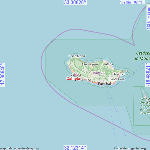
Calheta GPS coordinates[2]
32° 43' 0.012" North, 17° 10' 59.988" West
| Map corner | latitude | longitude |
|---|---|---|
| Upper-left | 33.30628°, | -17.88646° |
| Center: | 32.71667°, | -17.18333° |
| Lower-right: | 32.12314°, | -16.48021° |
| Map W x H: | 131.6×131.6 km | = 81.8×81.8mi |
| max Lat: | 42.11337° ⇑98.1% North |
| Calheta: | 32.71667° |
| min Lat: | ⇓1.9% South 32.6448° |
| min Long | Calheta | max Long |
| -31.17847° | -17.18333° | -6.27308° |
| W 7.4%⇐ | ⇒92.6% E |
Elevation
Elevation of Calheta is 120 m = 394 ft, and this is 57 m = 187 ft below average elevation for this country.
| Max E: |
1008 m = 3307 ft | 47.9% |
| Avg. | 177 m = 581 ft | |
| Calheta | 120 m = 394 ft | |
Min E: |
-128 m = -420 ft | 52.1% |
See also: Portugal elevation on elevation.city.
Geographical zone
Calheta is located in North temperate zone (between Tropic of Cancer and the Arctic Circle). Distance of this Northern Tropic circle is 1031.8 km =641.1 mi to South.| Distance of | km | miles | from Calheta |
|---|---|---|---|
| North Pole | 6369.3 | 3957.7 | to North |
| Arctic Circle | 3763.4 | 2338.5 | to North |
| Tropic Cancer | 1031.8 | 641.1 | to South |
| Equator | 3637.8 | 2260.4 | to South |


Nearby cities:
15 places around Calheta: (largest is in red/bold)
• Arco da Calheta
3.1 km =1.9 mi,  93°
93°
• Campanário
14.9 km =9.3 mi,  112°
112°
• Canhas
8.3 km =5.2 mi, 107°
• Estreito da Calheta
2.3 km =1.4 mi,  351°
351°
• Fajã da Ovelha
8 km =5 mi,  323°
323°
• Lugar de Baixo
9.9 km =6.2 mi, 114°
• Madalena do Mar
4.8 km =3 mi, 111°
• Paul do Mar
6.4 km =4 mi, 316°
• Ponta do Pargo
12.2 km =7.6 mi,  329°
329°
• Ponta do Sol
8.8 km =5.5 mi,  117°
117°
• Porto Moniz
16.8 km =10.4 mi,  5°
5°
• Prazeres
4.3 km =2.7 mi, 332°
• Ribeira Brava
12.2 km =7.6 mi, 112°
• Seixal
13.7 km =8.5 mi,  30°
30°
• São Vicente
15.8 km =9.8 mi,  55°
55°
Sources, notices
• [Note1] Compared only with cities in Portugal existing in our database
• [Src1] Map data: © OpenStreetMap contributors (CC-BY-SA)
• [Src2] Other city data from geonames.org with taken over terms of usage.
• [Src3] Geographical zone / Annual Mean Temperature by Robert A. Rohde @ Wikipedia
