São Vicente geodata
São Vicente (Madeira) is a populated place; located in Portugal in Atlantic/Madeira (GMT+0) time zone. With population of 6,063 people, there are 355 cities with bigger population in this country. Compared to other cities in Portugal, 96.9% of cities are located further ↑North; 91.6% of cities are located further →East and 50.3% of cities have higher elevation than São Vicente. Note1


São Vicente GPS coordinates[2]
32° 47' 48.228" North, 17° 2' 35.628" West
| Map corner | latitude | longitude |
|---|---|---|
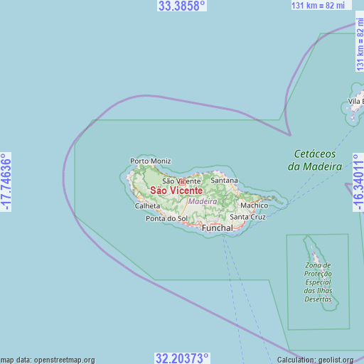
| Upper-left | 33.3858°, | -17.74636° |
| Center: | 32.79673°, | -17.04323° |
| Lower-right: | 32.20373°, | -16.34011° |
| Map W x H: | 131.4×131.4 km | = 81.6×81.6mi |
| max Lat: | 42.11337° ⇑96.9% North |
| São Vicente: | 32.79673° |
| min Lat: | ⇓3.1% South 32.6448° |
| min Long | São Vicente | max Long |
| -31.17847° | -17.04323° | -6.27308° |
| W 8.4%⇐ | ⇒91.6% E |
Elevation
Elevation of São Vicente is 111 m = 364 ft, and this is 66 m = 217 ft below average elevation for this country.
| Max E: |
1008 m = 3307 ft | 50.3% |
| Avg. | 177 m = 581 ft | |
| São Vicente | 111 m = 364 ft | |
Min E: |
-128 m = -420 ft | 49.7% |
See also: Portugal elevation on elevation.city.
Geographical zone
São Vicente is located in North temperate zone (between Tropic of Cancer and the Arctic Circle). Distance of this Northern Tropic circle is 1040.7 km =646.7 mi to South.| Distance of | km | miles | from São Vicente |
|---|---|---|---|
| North Pole | 6360.4 | 3952.2 | to North |
| Arctic Circle | 3754.5 | 2332.9 | to North |
| Tropic Cancer | 1040.7 | 646.7 | to South |
| Equator | 3646.7 | 2266 | to South |


Nearby cities:
15 places around São Vicente: (largest is in red/bold)
• Arco da Calheta
13.5 km =8.4 mi,  227°
227°
• Boaventura
7 km =4.3 mi,  69°
69°
• Calheta
15.8 km =9.8 mi,  235°
235°
• Campanário
14.6 km =9.1 mi,  177°
177°
• Canhas
12.5 km =7.8 mi,  204°
204°
• Curral das Freiras
10.9 km =6.8 mi,  141°
141°
• Estreito da Calheta
15 km =9.3 mi, 243°
• Lugar de Baixo
13.6 km =8.5 mi, 197°
• Madalena do Mar
13.7 km =8.5 mi,  218°
218°
• Ponta do Sol
14 km =8.7 mi, 202°
• Porto Moniz
13.9 km =8.6 mi,  304°
304°
• Ribeira Brava
13.7 km =8.5 mi,  187°
187°
• Santana
14.9 km =9.3 mi,  88°
88°
• Seixal
6.9 km =4.3 mi, 295°
• São Jorge
13.6 km =8.5 mi,  80°
80°
Sources, notices
• [Note1] Compared only with cities in Portugal existing in our database
• [Src1] Map data: © OpenStreetMap contributors (CC-BY-SA)
• [Src2] Other city data from geonames.org with taken over terms of usage.
• [Src3] Geographical zone / Annual Mean Temperature by Robert A. Rohde @ Wikipedia
