Ribeira Quente geodata
Ribeira Quente (Azores) is a populated place; located in Portugal in Atlantic/Azores (GMT+0) time zone. With population of 767 people, there are 787 cities with bigger population in this country. Compared to other cities in Portugal, 87.7% of cities are located further ↑North; 93.6% of cities are located further →East and 98.9% of cities have higher elevation than Ribeira Quente. Note1


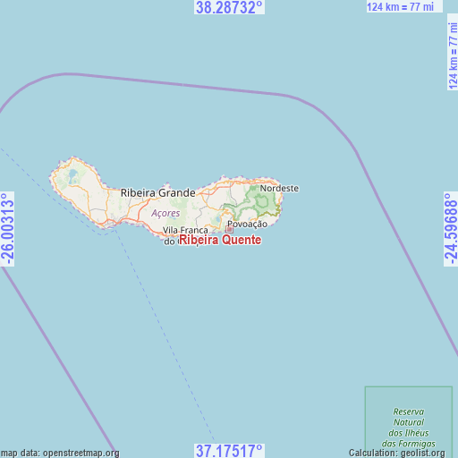
Ribeira Quente GPS coordinates[2]
37° 43' 59.988" North, 25° 18' 0" West
| Map corner | latitude | longitude |
|---|---|---|
| Upper-left | 38.28732°, | -26.00313° |
| Center: | 37.73333°, | -25.3° |
| Lower-right: | 37.17517°, | -24.59688° |
| Map W x H: | 123.7×123.7 km | = 76.9×76.9mi |
| max Lat: | 42.11337° ⇑87.7% North |
| Ribeira Quente: | 37.73333° |
| min Lat: | ⇓12.3% South 32.6448° |
| min Long | Ribeira Quente | max Long |
| -31.17847° | -25.3° | -6.27308° |
| W 6.4%⇐ | ⇒93.6% E |
Elevation
Elevation of Ribeira Quente is 2 m = 7 ft, and this is 175 m = 574 ft below average elevation for this country.
| Max E: |
1008 m = 3307 ft | 98.9% |
| Avg. | 177 m = 581 ft | |
| Ribeira Quente | 2 m = 7 ft | |
Min E: |
-128 m = -420 ft | 1.1% |
See also: Portugal elevation on elevation.city.
Geographical zone
Ribeira Quente is located in North temperate zone (between Tropic of Cancer and the Arctic Circle). Distance of this Northern Tropic circle is 1589.6 km =987.7 mi to South.| Distance of | km | miles | from Ribeira Quente |
|---|---|---|---|
| North Pole | 5811.5 | 3611.1 | to North |
| Arctic Circle | 3205.6 | 1991.9 | to North |
| Tropic Cancer | 1589.6 | 987.7 | to South |
| Equator | 4195.6 | 2607 | to South |


Nearby cities:
15 places around Ribeira Quente: (largest is in red/bold)
• Cabouco
23.7 km =14.7 mi,  278°
278°
• Fenais da Ajuda
13.3 km =8.3 mi,  350°
350°
• Furnas
4.8 km =3 mi, 349°
• Lagoa
23.9 km =14.9 mi,  273°
273°
• Maia
13.6 km =8.5 mi,  324°
324°
• Ponta Garça
6.1 km =3.8 mi,  252°
252°
• Povoação
4.8 km =3 mi,  67°
67°
• Rabo de Peixe
26.3 km =16.3 mi,  288°
288°
• Ribeira Grande
21.8 km =13.5 mi,  296°
296°
• Ribeira Seca
10.4 km =6.5 mi,  263°
263°
• Ribeira Seca
22.5 km =14 mi, 294°
• Ribeira das Tainhas
9.4 km =5.8 mi, 259°
• Senhora do Rosário
17.2 km =10.7 mi,  49°
49°
• Vila Franca do Campo
11.9 km =7.4 mi, 261°
• Água de Pau
18.7 km =11.6 mi, 265°
Sources, notices
• [Note1] Compared only with cities in Portugal existing in our database
• [Src1] Map data: © OpenStreetMap contributors (CC-BY-SA)
• [Src2] Other city data from geonames.org with taken over terms of usage.
• [Src3] Geographical zone / Annual Mean Temperature by Robert A. Rohde @ Wikipedia
