Sonsorol Village geodata
Sonsorol Village (Sonsorol) is a seat of a first-order administrative division; located in Palau in Pacific/Palau (GMT+9) time zone. With population of 30 people, there are 15 cities with bigger population in this country. Compared to other cities in Palau, 94.1% of cities are located further ↑North; 94.1% of cities are located further →East and 100% of cities have higher elevation than Sonsorol Village. Note1


Sonsorol Village GPS coordinates[2]
5° 19' 33.888" North, 132° 13' 9.948" East
| Map corner | latitude | longitude |
|---|---|---|
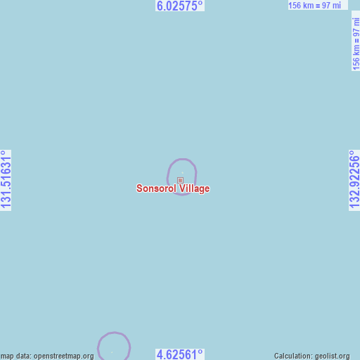
| Upper-left | 6.02575°, | 131.51631° |
| Center: | 5.32608°, | 132.21943° |
| Lower-right: | 4.62561°, | 132.92256° |
| Map W x H: | 155.7×155.7 km | = 96.7×96.7mi |
| max Lat: | 8.08228° ⇑94.1% North |
| Sonsorol Village: | 5.32608° |
| min Lat: | ⇓5.9% South 3.00488° |
| min Long | Sonsorol Villag | max Long |
| 131.12168° | 132.21943° | 134.71725° |
| W 5.9%⇐ | ⇒94.1% E |
Elevation
Elevation of Sonsorol Village is 7 m = 23 ft, and this is 17.7 m = 58 ft below average elevation for this country.
| Max E: |
72 m = 236 ft | 100% |
| Avg. | 24.7 m = 81 ft | |
| Sonsorol Village | 7 m = 23 ft | |
Min E: |
7 m = 23 ft | 0% |
See also: Palau elevation on elevation.city.
Geographical zone
Sonsorol Village is located in North Torrid zone (between Equator and Tropic of Cancer). Distance of Equator is 592.2 km =368 mi to South.| Distance of | km | miles | from Sonsorol Village |
|---|---|---|---|
| North Pole | 9414.9 | 5850.1 | to North |
| Arctic Circle | 6809 | 4230.9 | to North |
| Tropic Cancer | 2013.7 | 1251.3 | to North |
| Equator | 592.2 | 368 | to South |


Nearby cities:
15 places around Sonsorol Village: (largest is in red/bold)
• Angaur State
274.7 km =170.7 mi,  50°
50°
• Imeong Hamlet
353.7 km =219.8 mi, 46°
• Kloulklubed
295.1 km =183.4 mi, 49°
• Koror
334.9 km =208.1 mi, 48°
• Koror Town
335.6 km =208.5 mi, 48°
• Melekeok Village
359.9 km =223.6 mi, 47°
• Ngardmau
363.5 km =225.9 mi, 45°
• Ngchemiangel
343.2 km =213.3 mi, 46°
• Ngchesar Hamlet
355.7 km =221 mi, 47°
• Ngereklmadel
347.1 km =215.7 mi, 46°
• Ngerkeai
364.3 km =226.4 mi, 47°
• Ngerulmud
359.2 km =223.2 mi, 47°
• Ngetkib
340.2 km =211.4 mi, 48°
• Tobi Village
285.4 km =177.3 mi,  205°
205°
• Ulimang
370 km =229.9 mi, 46°
Sources, notices
• [Note1] Compared only with cities in Palau existing in our database
• [Src1] Map data: © OpenStreetMap contributors (CC-BY-SA)
• [Src2] Other city data from geonames.org with taken over terms of usage.
• [Src3] Geographical zone / Annual Mean Temperature by Robert A. Rohde @ Wikipedia
