Zdrapți geodata
Zdrapți (Hunedoara) is a populated place; located in Romania in Europe/Bucharest (GMT+3) time zone. With population of 1,294 people, there are 3542 cities with bigger population in this country. Compared to other cities in Romania, 58.7% of cities are located further ↓South; 86.3% of cities are located further →East and 67.4% of cities have lower elevation than Zdrapți. Note1


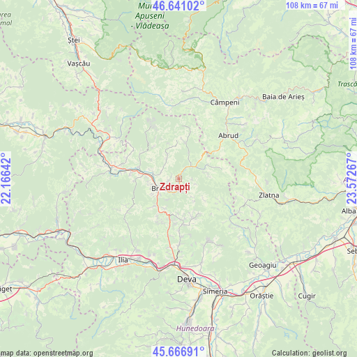
Zdrapți GPS coordinates[2]
46° 9' 22.032" North, 22° 52' 10.344" East
| Map corner | latitude | longitude |
|---|---|---|
| Upper-left | 46.64102°, | 22.16642° |
| Center: | 46.15612°, | 22.86954° |
| Lower-right: | 45.66691°, | 23.57267° |
| Map W x H: | 108.3×108.3 km | = 67.3×67.3mi |
| max Lat: | 48.23793° ⇑41.3% North |
| Zdrapți: | 46.15612° |
| min Lat: | ⇓58.7% South 43.65638° |
| min Long | Zdrapți | max Long |
| 20.31667° | 22.86954° | 29.65403° |
| W 13.7%⇐ | ⇒86.3% E |
Elevation
Elevation of Zdrapți is 304 m = 997 ft, and this is 49.1 m = 161 ft above average elevation for this country.
| Max E: |
1278 m = 4193 ft | 32.6% |
| Zdrapți | 304 m 997 ft | |
| Avg. | 254.9 m = 836 ft | |
Min E: |
-2 m = -7 ft | 67.4% |
See also: Romania elevation on elevation.city.
Geographical zone
Zdrapți is located in North temperate zone (between Tropic of Cancer and the Arctic Circle). Distance of this North polar circle is 2269.1 km =1410 mi to North.| Distance of | km | miles | from Zdrapți |
|---|---|---|---|
| North Pole | 4875 | 3029.2 | to North |
| Arctic Circle | 2269.1 | 1410 | to North |
| Tropic Cancer | 2526.2 | 1569.7 | to South |
| Equator | 5132.1 | 3188.9 | to South |


Nearby cities:
15 places around Zdrapți: (largest is in red/bold)
• Barza
4.1 km =2.5 mi,  193°
193°
• Blăjeni
8.9 km =5.5 mi,  15°
15°
• Brad
7.1 km =4.4 mi,  249°
249°
• Buceş
5.8 km =3.6 mi,  58°
58°
• Bucureşci
3.5 km =2.2 mi,  137°
137°
• Crişcior
4.4 km =2.7 mi,  182°
182°
• Crișan
5.7 km =3.5 mi,  286°
286°
• Luncoiu de Sus
9.9 km =6.2 mi,  205°
205°
• Mesteacăn
8.3 km =5.2 mi,  260°
260°
• Mihăileni
3.8 km =2.4 mi,  33°
33°
• Ribiţa
8.5 km =5.3 mi, 290°
• Stănija
9.1 km =5.7 mi,  77°
77°
• Valea Bradului
3.2 km =2 mi, 260°
• Șesuri
7.9 km =4.9 mi,  146°
146°
• Țărățel
5.3 km =3.3 mi,  225°
225°
Sources, notices
• [Note1] Compared only with cities in Romania existing in our database
• [Src1] Map data: © OpenStreetMap contributors (CC-BY-SA)
• [Src2] Other city data from geonames.org with taken over terms of usage.
• [Src3] Geographical zone / Annual Mean Temperature by Robert A. Rohde @ Wikipedia
