Țărățel geodata
Țărățel (Hunedoara) is a populated place; located in Romania in Europe/Bucharest (GMT+3) time zone. With population of 644 people, there are 5909 cities with bigger population in this country. Compared to other cities in Romania, 57.9% of cities are located further ↓South; 86.9% of cities are located further →East and 64.9% of cities have lower elevation than Țărățel. Note1


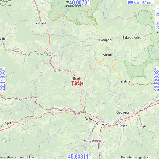
Țărățel GPS coordinates[2]
46° 7' 21.396" North, 22° 49' 11.82" East
| Map corner | latitude | longitude |
|---|---|---|
| Upper-left | 46.6078°, | 22.11683° |
| Center: | 46.12261°, | 22.81995° |
| Lower-right: | 45.63311°, | 23.52308° |
| Map W x H: | 108.4×108.4 km | = 67.4×67.4mi |
| max Lat: | 48.23793° ⇑42.1% North |
| Țărățel: | 46.12261° |
| min Lat: | ⇓57.9% South 43.65638° |
| min Long | Țărățel | max Long |
| 20.31667° | 22.81995° | 29.65403° |
| W 13.1%⇐ | ⇒86.9% E |
Elevation
Elevation of Țărățel is 289 m = 948 ft, and this is 34.1 m = 112 ft above average elevation for this country.
| Max E: |
1278 m = 4193 ft | 35.1% |
| Țărățel | 289 m 948 ft | |
| Avg. | 254.9 m = 836 ft | |
Min E: |
-2 m = -7 ft | 64.9% |
See also: Romania elevation on elevation.city.
Geographical zone
Țărățel is located in North temperate zone (between Tropic of Cancer and the Arctic Circle). Distance of this North polar circle is 2272.8 km =1412.3 mi to North.| Distance of | km | miles | from Țărățel |
|---|---|---|---|
| North Pole | 4878.7 | 3031.5 | to North |
| Arctic Circle | 2272.8 | 1412.3 | to North |
| Tropic Cancer | 2522.4 | 1567.3 | to South |
| Equator | 5128.4 | 3186.6 | to South |


Nearby cities:
15 places around Țărățel: (largest is in red/bold)
• Barza
2.9 km =1.8 mi,  96°
96°
• Brad
3.1 km =1.9 mi,  292°
292°
• Bucureşci
6.3 km =3.9 mi,  79°
79°
• Crişcior
3.7 km =2.3 mi, 100°
• Crișan
5.6 km =3.5 mi,  342°
342°
• Luncoiu de Jos
4.8 km =3 mi,  238°
238°
• Luncoiu de Sus
5.2 km =3.2 mi,  185°
185°
• Mesteacăn
5 km =3.1 mi,  297°
297°
• Ormindea
8.3 km =5.2 mi,  157°
157°
• Ribiţa
7.9 km =4.9 mi,  328°
328°
• Valea Bradului
3.3 km =2.1 mi,  12°
12°
• Vălişoara
8.4 km =5.2 mi, 163°
• Zdrapți
5.3 km =3.3 mi,  45°
45°
• Șesuri
8.7 km =5.4 mi,  109°
109°
• Țebea
8.7 km =5.4 mi, 299°
Sources, notices
• [Note1] Compared only with cities in Romania existing in our database
• [Src1] Map data: © OpenStreetMap contributors (CC-BY-SA)
• [Src2] Other city data from geonames.org with taken over terms of usage.
• [Src3] Geographical zone / Annual Mean Temperature by Robert A. Rohde @ Wikipedia
