Zagra geodata
Zagra (Bistriţa-Năsăud) is a seat of a second-order administrative division; located in Romania in Europe/Bucharest (GMT+3) time zone. With population of 3,725 people, there are 1310 cities with bigger population in this country. Compared to other cities in Romania, 87.3% of cities are located further ↓South; 64.2% of cities are located further →East and 84.6% of cities have lower elevation than Zagra. Note1


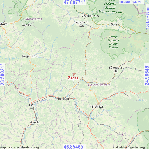
Zagra GPS coordinates[2]
47° 19' 59.988" North, 24° 16' 59.988" East
| Map corner | latitude | longitude |
|---|---|---|
| Upper-left | 47.80771°, | 23.58021° |
| Center: | 47.33333°, | 24.28333° |
| Lower-right: | 46.85465°, | 24.98646° |
| Map W x H: | 106×106 km | = 65.9×65.9mi |
| max Lat: | 48.23793° ⇑12.7% North |
| Zagra: | 47.33333° |
| min Lat: | ⇓87.3% South 43.65638° |
| min Long | Zagra | max Long |
| 20.31667° | 24.28333° | 29.65403° |
| W 35.8%⇐ | ⇒64.2% E |
Elevation
Elevation of Zagra is 442 m = 1450 ft, and this is 187.1 m = 614 ft above average elevation for this country.
| Max E: |
1278 m = 4193 ft | 15.4% |
| Zagra | 442 m 1450 ft | |
| Avg. | 254.9 m = 836 ft | |
Min E: |
-2 m = -7 ft | 84.6% |
See also: Romania elevation on elevation.city.
Geographical zone
Zagra is located in North temperate zone (between Tropic of Cancer and the Arctic Circle). Distance of this North polar circle is 2138.2 km =1328.6 mi to North.| Distance of | km | miles | from Zagra |
|---|---|---|---|
| North Pole | 4744.1 | 2947.8 | to North |
| Arctic Circle | 2138.2 | 1328.6 | to North |
| Tropic Cancer | 2657.1 | 1651 | to South |
| Equator | 5263 | 3270.3 | to South |


Nearby cities:
15 places around Zagra: (largest is in red/bold)
• Borleasa
8.1 km =5 mi,  280°
280°
• Coşbuc
8.9 km =5.5 mi,  66°
66°
• Mititei
6.1 km =3.8 mi,  155°
155°
• Mocod
7.9 km =4.9 mi,  172°
172°
• Nimigea de Jos
9 km =5.6 mi, 171°
• Nimigea de Sus
6.1 km =3.8 mi, 155°
• Năsăud
10.4 km =6.5 mi,  122°
122°
• Perișor
4.7 km =2.9 mi,  243°
243°
• Piatra
9.5 km =5.9 mi,  188°
188°
• Poienile Zagrei
6.3 km =3.9 mi,  341°
341°
• Runcu Salvei
3.4 km =2.1 mi, 69°
• Răpănaşu
9.4 km =5.8 mi,  306°
306°
• Salva
6.2 km =3.9 mi,  126°
126°
• Spermezeu
10.7 km =6.6 mi,  249°
249°
• Târlişua
9.4 km =5.8 mi, 306°
Sources, notices
• [Note1] Compared only with cities in Romania existing in our database
• [Src1] Map data: © OpenStreetMap contributors (CC-BY-SA)
• [Src2] Other city data from geonames.org with taken over terms of usage.
• [Src3] Geographical zone / Annual Mean Temperature by Robert A. Rohde @ Wikipedia
