Borleasa geodata
Borleasa (Bistriţa-Năsăud) is a populated place; located in Romania in Europe/Bucharest (GMT+3) time zone. With population of 560 people, there are 6501 cities with bigger population in this country. Compared to other cities in Romania, 87.6% of cities are located further ↓South; 66.3% of cities are located further →East and 75.6% of cities have lower elevation than Borleasa. Note1


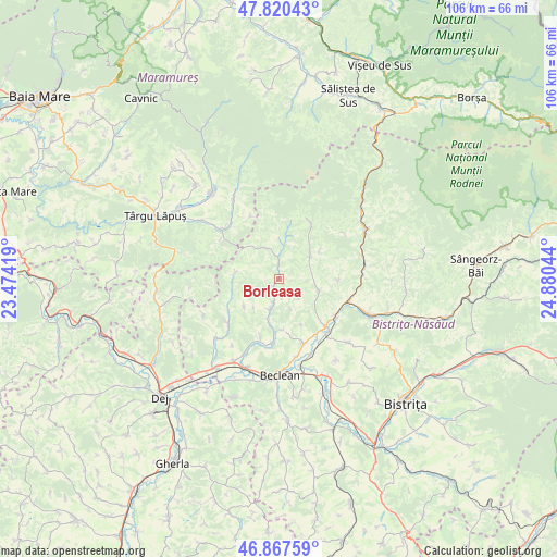
Borleasa GPS coordinates[2]
47° 20' 46.176" North, 24° 10' 38.316" East
| Map corner | latitude | longitude |
|---|---|---|
| Upper-left | 47.82043°, | 23.47419° |
| Center: | 47.34616°, | 24.17731° |
| Lower-right: | 46.86759°, | 24.88044° |
| Map W x H: | 105.9×105.9 km | = 65.8×65.8mi |
| max Lat: | 48.23793° ⇑12.4% North |
| Borleasa: | 47.34616° |
| min Lat: | ⇓87.6% South 43.65638° |
| min Long | Borleasa | max Long |
| 20.31667° | 24.17731° | 29.65403° |
| W 33.7%⇐ | ⇒66.3% E |
Elevation
Elevation of Borleasa is 358 m = 1175 ft, and this is 103.1 m = 338 ft above average elevation for this country.
| Max E: |
1278 m = 4193 ft | 24.4% |
| Borleasa | 358 m 1175 ft | |
| Avg. | 254.9 m = 836 ft | |
Min E: |
-2 m = -7 ft | 75.6% |
See also: Romania elevation on elevation.city.
Geographical zone
Borleasa is located in North temperate zone (between Tropic of Cancer and the Arctic Circle). Distance of this North polar circle is 2136.8 km =1327.7 mi to North.| Distance of | km | miles | from Borleasa |
|---|---|---|---|
| North Pole | 4742.7 | 2947 | to North |
| Arctic Circle | 2136.8 | 1327.7 | to North |
| Tropic Cancer | 2658.5 | 1651.9 | to South |
| Equator | 5264.4 | 3271.1 | to South |


Nearby cities:
15 places around Borleasa: (largest is in red/bold)
• Agrieș
6.8 km =4.2 mi,  332°
332°
• Breaza
8.7 km =5.4 mi,  273°
273°
• Ciceu-Poieni
8.4 km =5.2 mi,  232°
232°
• Dobric
11.7 km =7.3 mi,  198°
198°
• Dobricel
7.3 km =4.5 mi,  221°
221°
• Dumbrăvița
9.8 km =6.1 mi,  176°
176°
• Nimigea de Sus
12.6 km =7.8 mi,  123°
123°
• Perișor
5.2 km =3.2 mi,  133°
133°
• Poienile Zagrei
7.5 km =4.7 mi,  52°
52°
• Runcu Salvei
11.2 km =7 mi,  91°
91°
• Răpănaşu
4.2 km =2.6 mi,  6°
6°
• Spermezeu
5.5 km =3.4 mi, 201°
• Suplai
11.8 km =7.3 mi,  31°
31°
• Târlişua
4.2 km =2.6 mi, 6°
• Zagra
8.1 km =5 mi,  100°
100°
Sources, notices
• [Note1] Compared only with cities in Romania existing in our database
• [Src1] Map data: © OpenStreetMap contributors (CC-BY-SA)
• [Src2] Other city data from geonames.org with taken over terms of usage.
• [Src3] Geographical zone / Annual Mean Temperature by Robert A. Rohde @ Wikipedia
