Urseiu geodata
Urseiu (Dâmboviţa) is a populated place; located in Romania in Europe/Bucharest (GMT+3) time zone. With population of 915 people, there are 4556 cities with bigger population in this country. Compared to other cities in Romania, 64.3% of cities are located further ↑North; 55.5% of cities are located further ←West and 80.4% of cities have lower elevation than Urseiu. Note1


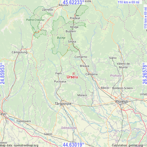
Urseiu GPS coordinates[2]
45° 7' 42.312" North, 25° 33' 45.54" East
| Map corner | latitude | longitude |
|---|---|---|
| Upper-left | 45.62233°, | 24.85953° |
| Center: | 45.12842°, | 25.56265° |
| Lower-right: | 44.63019°, | 26.26578° |
| Map W x H: | 110.3×110.3 km | = 68.5×68.5mi |
| max Lat: | 48.23793° ⇑64.3% North |
| Urseiu: | 45.12842° |
| min Lat: | ⇓35.7% South 43.65638° |
| min Long | Urseiu | max Long |
| 20.31667° | 25.56265° | 29.65403° |
| W 55.5%⇐ | ⇒44.5% E |
Elevation
Elevation of Urseiu is 397 m = 1302 ft, and this is 142.1 m = 466 ft above average elevation for this country.
| Max E: |
1278 m = 4193 ft | 19.6% |
| Urseiu | 397 m 1302 ft | |
| Avg. | 254.9 m = 836 ft | |
Min E: |
-2 m = -7 ft | 80.4% |
See also: Romania elevation on elevation.city.
Geographical zone
Urseiu is located in North temperate zone (between Tropic of Cancer and the Arctic Circle). Distance of this North polar circle is 2383.4 km =1481 mi to North.| Distance of | km | miles | from Urseiu |
|---|---|---|---|
| North Pole | 4989.3 | 3100.2 | to North |
| Arctic Circle | 2383.4 | 1481 | to North |
| Tropic Cancer | 2411.9 | 1498.7 | to South |
| Equator | 5017.8 | 3117.9 | to South |


Nearby cities:
15 places around Urseiu: (largest is in red/bold)
• Adunaţi
4.3 km =2.7 mi,  82°
82°
• Bezdead
4.3 km =2.7 mi,  303°
303°
• Izvoru
6.2 km =3.9 mi,  200°
200°
• Măgura
7.1 km =4.4 mi,  268°
268°
• Proviţa de Jos
7 km =4.3 mi,  100°
100°
• Proviţa de Sus
5.6 km =3.5 mi, 84°
• Surdești
8.4 km =5.2 mi,  35°
35°
• Valea Leurzii
7.1 km =4.4 mi, 301°
• Valea Lungă Gorgota
7.1 km =4.4 mi,  181°
181°
• Valea Lungă Ogrea
7.9 km =4.9 mi,  164°
164°
• Valea Lungă-Cricov
7.3 km =4.5 mi, 164°
• Valea Târsei
7.7 km =4.8 mi,  45°
45°
• Vişineşti
3.3 km =2.1 mi, 197°
• Vârfuri
4.8 km =3 mi,  228°
228°
• Ștubeie Tisa
7.6 km =4.7 mi,  206°
206°
Sources, notices
• [Note1] Compared only with cities in Romania existing in our database
• [Src1] Map data: © OpenStreetMap contributors (CC-BY-SA)
• [Src2] Other city data from geonames.org with taken over terms of usage.
• [Src3] Geographical zone / Annual Mean Temperature by Robert A. Rohde @ Wikipedia
