Urlueni geodata
Urlueni (Arges) is a populated place; located in Romania in Europe/Bucharest (GMT+3) time zone. With population of 850 people, there are 4839 cities with bigger population in this country. Compared to other cities in Romania, 85.6% of cities are located further ↑North; 55.9% of cities are located further →East and 60.1% of cities have higher elevation than Urlueni. Note1


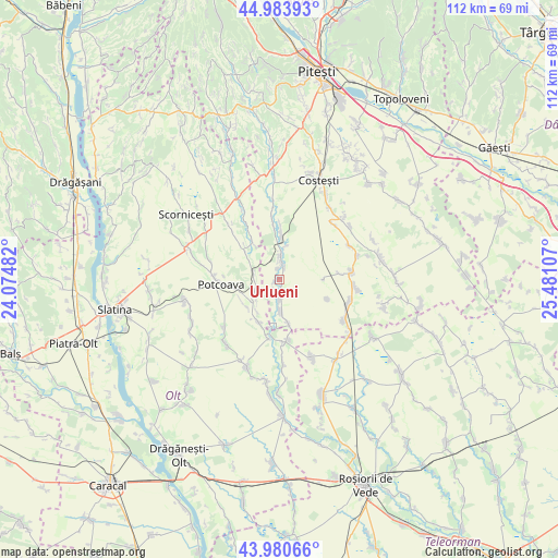
Urlueni GPS coordinates[2]
44° 29' 4.02" North, 24° 46' 40.584" East
| Map corner | latitude | longitude |
|---|---|---|
| Upper-left | 44.98393°, | 24.07482° |
| Center: | 44.48445°, | 24.77794° |
| Lower-right: | 43.98066°, | 25.48107° |
| Map W x H: | 111.6×111.6 km | = 69.3×69.3mi |
| max Lat: | 48.23793° ⇑85.6% North |
| Urlueni: | 44.48445° |
| min Lat: | ⇓14.4% South 43.65638° |
| min Long | Urlueni | max Long |
| 20.31667° | 24.77794° | 29.65403° |
| W 44.1%⇐ | ⇒55.9% E |
Elevation
Elevation of Urlueni is 166 m = 545 ft, and this is 88.9 m = 292 ft below average elevation for this country.
| Max E: |
1278 m = 4193 ft | 60.1% |
| Avg. | 254.9 m = 836 ft | |
| Urlueni | 166 m = 545 ft | |
Min E: |
-2 m = -7 ft | 39.9% |
See also: Romania elevation on elevation.city.
Geographical zone
Urlueni is located in North temperate zone (between Tropic of Cancer and the Arctic Circle). Distance of this Northern Tropic circle is 2340.3 km =1454.2 mi to South.| Distance of | km | miles | from Urlueni |
|---|---|---|---|
| North Pole | 5060.9 | 3144.7 | to North |
| Arctic Circle | 2455 | 1525.5 | to North |
| Tropic Cancer | 2340.3 | 1454.2 | to South |
| Equator | 4946.2 | 3073.4 | to South |


Nearby cities:
15 places around Urlueni: (largest is in red/bold)
• Bârla
6.5 km =4 mi,  180°
180°
• Ciocești
4.1 km =2.5 mi,  173°
173°
• Corbu
4.9 km =3 mi,  268°
268°
• Hârseşti
5.5 km =3.4 mi,  4°
4°
• Icoana
9 km =5.6 mi,  212°
212°
• Milcoveni
7.8 km =4.8 mi, 213°
• Mozăcenii-Vale
9.6 km =6 mi, 169°
• Potcoava
10.1 km =6.3 mi, 269°
• Satu Nou
8.6 km =5.3 mi,  90°
90°
• Sinești
9.1 km =5.7 mi,  258°
258°
• Stolnici
9.2 km =5.7 mi, 2°
• Sârbii-Măgura
8.8 km =5.5 mi,  326°
326°
• Ursoaia
8.6 km =5.3 mi,  229°
229°
• Valea Merilor
9.8 km =6.1 mi, 261°
• Vitănești
8.1 km =5 mi,  306°
306°
Sources, notices
• [Note1] Compared only with cities in Romania existing in our database
• [Src1] Map data: © OpenStreetMap contributors (CC-BY-SA)
• [Src2] Other city data from geonames.org with taken over terms of usage.
• [Src3] Geographical zone / Annual Mean Temperature by Robert A. Rohde @ Wikipedia
