Bârla geodata
Bârla (Arges) is a seat of a second-order administrative division; located in Romania in Europe/Bucharest (GMT+3) time zone. With population of 5,795 people, there are 580 cities with bigger population in this country. Compared to other cities in Romania, 87.5% of cities are located further ↑North; 55.9% of cities are located further →East and 63.9% of cities have higher elevation than Bârla. Note1


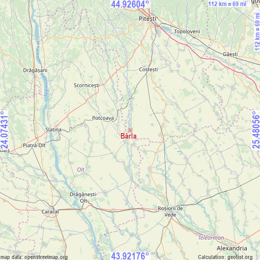
Bârla GPS coordinates[2]
44° 25' 33.816" North, 24° 46' 38.748" East
| Map corner | latitude | longitude |
|---|---|---|
| Upper-left | 44.92604°, | 24.07431° |
| Center: | 44.42606°, | 24.77743° |
| Lower-right: | 43.92176°, | 25.48056° |
| Map W x H: | 111.7×111.7 km | = 69.4×69.4mi |
| max Lat: | 48.23793° ⇑87.5% North |
| Bârla: | 44.42606° |
| min Lat: | ⇓12.5% South 43.65638° |
| min Long | Bârla | max Long |
| 20.31667° | 24.77743° | 29.65403° |
| W 44.1%⇐ | ⇒55.9% E |
Elevation
Elevation of Bârla is 151 m = 495 ft, and this is 103.9 m = 341 ft below average elevation for this country.
| Max E: |
1278 m = 4193 ft | 63.9% |
| Avg. | 254.9 m = 836 ft | |
| Bârla | 151 m = 495 ft | |
Min E: |
-2 m = -7 ft | 36.1% |
See also: Romania elevation on elevation.city.
Geographical zone
Bârla is located in North temperate zone (between Tropic of Cancer and the Arctic Circle). Distance of this Northern Tropic circle is 2333.8 km =1450.2 mi to South.| Distance of | km | miles | from Bârla |
|---|---|---|---|
| North Pole | 5067.3 | 3148.7 | to North |
| Arctic Circle | 2461.5 | 1529.5 | to North |
| Tropic Cancer | 2333.8 | 1450.2 | to South |
| Equator | 4939.7 | 3069.4 | to South |


Nearby cities:
15 places around Bârla: (largest is in red/bold)
• Barza
10.3 km =6.4 mi,  177°
177°
• Burdea
9.9 km =6.2 mi,  75°
75°
• Ciocești
2.4 km =1.5 mi,  12°
12°
• Corbu
8 km =5 mi,  322°
322°
• Floru
5.8 km =3.6 mi,  196°
196°
• Icoana
4.9 km =3 mi,  257°
257°
• Milcoveni
4.3 km =2.7 mi,  270°
270°
• Mozăcenii-Vale
3.4 km =2.1 mi,  148°
148°
• Satu Nou
10.8 km =6.7 mi,  53°
53°
• Sinești
10 km =6.2 mi,  297°
297°
• Stoborăști
9.4 km =5.8 mi, 176°
• Tufeni
6.6 km =4.1 mi, 175°
• Urlueni
6.5 km =4 mi,  0°
0°
• Ursoaia
6.6 km =4.1 mi,  278°
278°
• Valea Merilor
10.9 km =6.8 mi, 297°
Sources, notices
• [Note1] Compared only with cities in Romania existing in our database
• [Src1] Map data: © OpenStreetMap contributors (CC-BY-SA)
• [Src2] Other city data from geonames.org with taken over terms of usage.
• [Src3] Geographical zone / Annual Mean Temperature by Robert A. Rohde @ Wikipedia
