Ungureni geodata
Ungureni (Maramureş) is a populated place; located in Romania in Europe/Bucharest (GMT+3) time zone. With population of 1,631 people, there are 3002 cities with bigger population in this country. Compared to other cities in Romania, 92% of cities are located further ↓South; 70.1% of cities are located further →East and 79.3% of cities have lower elevation than Ungureni. Note1


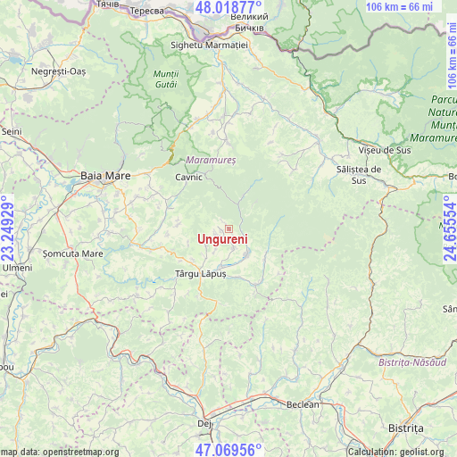
Ungureni GPS coordinates[2]
47° 32' 46.716" North, 23° 57' 8.676" East
| Map corner | latitude | longitude |
|---|---|---|
| Upper-left | 48.01877°, | 23.24929° |
| Center: | 47.54631°, | 23.95241° |
| Lower-right: | 47.06956°, | 24.65554° |
| Map W x H: | 105.5×105.5 km | = 65.6×65.6mi |
| max Lat: | 48.23793° ⇑8% North |
| Ungureni: | 47.54631° |
| min Lat: | ⇓92% South 43.65638° |
| min Long | Ungureni | max Long |
| 20.31667° | 23.95241° | 29.65403° |
| W 29.9%⇐ | ⇒70.1% E |
Elevation
Elevation of Ungureni is 387 m = 1270 ft, and this is 132.1 m = 433 ft above average elevation for this country.
| Max E: |
1278 m = 4193 ft | 20.7% |
| Ungureni | 387 m 1270 ft | |
| Avg. | 254.9 m = 836 ft | |
Min E: |
-2 m = -7 ft | 79.3% |
See also: Romania elevation on elevation.city.
Geographical zone
Ungureni is located in North temperate zone (between Tropic of Cancer and the Arctic Circle). Distance of this North polar circle is 2114.5 km =1313.9 mi to North.| Distance of | km | miles | from Ungureni |
|---|---|---|---|
| North Pole | 4720.4 | 2933.1 | to North |
| Arctic Circle | 2114.5 | 1313.9 | to North |
| Tropic Cancer | 2680.7 | 1665.7 | to South |
| Equator | 5286.7 | 3285 | to South |


Nearby cities:
15 places around Ungureni: (largest is in red/bold)
• Borcut
11 km =6.8 mi,  229°
229°
• Băiuţ
8.6 km =5.3 mi,  24°
24°
• Ciocotiș
11.8 km =7.3 mi,  275°
275°
• Costeni
3 km =1.9 mi,  250°
250°
• Cupşeni
1.5 km =0.9 mi,  285°
285°
• Dămăcușeni
10.4 km =6.5 mi,  198°
198°
• Fânațe
14 km =8.7 mi,  264°
264°
• Groșii Țibleșului
10.5 km =6.5 mi,  126°
126°
• Libotin
4.7 km =2.9 mi,  165°
165°
• Lăpuş
7.1 km =4.4 mi,  136°
136°
• Rogoz
8.9 km =5.5 mi,  189°
189°
• Suciu de Jos
11.4 km =7.1 mi, 168°
• Suciu de Sus
14 km =8.7 mi,  154°
154°
• Trestia
12.1 km =7.5 mi, 279°
• Târgu Lăpuş
12.3 km =7.6 mi,  212°
212°
Sources, notices
• [Note1] Compared only with cities in Romania existing in our database
• [Src1] Map data: © OpenStreetMap contributors (CC-BY-SA)
• [Src2] Other city data from geonames.org with taken over terms of usage.
• [Src3] Geographical zone / Annual Mean Temperature by Robert A. Rohde @ Wikipedia
