Fânațe geodata
Fânațe (Maramureş) is a populated place; located in Romania in Europe/Bucharest (GMT+3) time zone. With population of 665 people, there are 5780 cities with bigger population in this country. Compared to other cities in Romania, 91.5% of cities are located further ↓South; 73.1% of cities are located further →East and 73% of cities have lower elevation than Fânațe. Note1


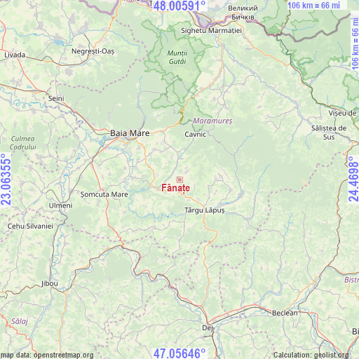
Fânațe GPS coordinates[2]
47° 31' 59.988" North, 23° 46' 0.012" East
| Map corner | latitude | longitude |
|---|---|---|
| Upper-left | 48.00591°, | 23.06355° |
| Center: | 47.53333°, | 23.76667° |
| Lower-right: | 47.05646°, | 24.4698° |
| Map W x H: | 105.6×105.6 km | = 65.6×65.6mi |
| max Lat: | 48.23793° ⇑8.5% North |
| Fânațe: | 47.53333° |
| min Lat: | ⇓91.5% South 43.65638° |
| min Long | Fânațe | max Long |
| 20.31667° | 23.76667° | 29.65403° |
| W 26.9%⇐ | ⇒73.1% E |
Elevation
Elevation of Fânațe is 340 m = 1115 ft, and this is 85.1 m = 279 ft above average elevation for this country.
| Max E: |
1278 m = 4193 ft | 27% |
| Fânațe | 340 m 1115 ft | |
| Avg. | 254.9 m = 836 ft | |
Min E: |
-2 m = -7 ft | 73% |
See also: Romania elevation on elevation.city.
Geographical zone
Fânațe is located in North temperate zone (between Tropic of Cancer and the Arctic Circle). Distance of this North polar circle is 2116 km =1314.8 mi to North.| Distance of | km | miles | from Fânațe |
|---|---|---|---|
| North Pole | 4721.9 | 2934.1 | to North |
| Arctic Circle | 2116 | 1314.8 | to North |
| Tropic Cancer | 2679.3 | 1664.8 | to South |
| Equator | 5285.2 | 3284.1 | to South |


Nearby cities:
15 places around Fânațe: (largest is in red/bold)
• Berința
6.8 km =4.2 mi,  276°
276°
• Borcut
8 km =5 mi,  135°
135°
• Cerneşti
2.2 km =1.4 mi,  214°
214°
• Cetățele
7.6 km =4.7 mi,  344°
344°
• Ciocotiș
3.4 km =2.1 mi,  40°
40°
• Copalnic
8.5 km =5.3 mi,  260°
260°
• Copalnic Mănăştur
7.3 km =4.5 mi,  239°
239°
• Cărbunari
10.3 km =6.4 mi,  296°
296°
• Dănești
10 km =6.2 mi,  345°
345°
• Făurești
3.5 km =2.2 mi, 339°
• Lăschia
2.8 km =1.7 mi,  293°
293°
• Plopiș
6.3 km =3.9 mi,  4°
4°
• Trestia
4 km =2.5 mi,  30°
30°
• Șindrești
9.8 km =6.1 mi,  326°
326°
• Șurdești
7.7 km =4.8 mi, 1°
Sources, notices
• [Note1] Compared only with cities in Romania existing in our database
• [Src1] Map data: © OpenStreetMap contributors (CC-BY-SA)
• [Src2] Other city data from geonames.org with taken over terms of usage.
• [Src3] Geographical zone / Annual Mean Temperature by Robert A. Rohde @ Wikipedia
