Ulma geodata
Ulma (Suceava) is a seat of a second-order administrative division; located in Romania in Europe/Bucharest (GMT+3) time zone. With population of 2,285 people, there are 2335 cities with bigger population in this country. Compared to other cities in Romania, 97.7% of cities are located further ↓South; 51.3% of cities are located further ←West and 96.4% of cities have lower elevation than Ulma. Note1


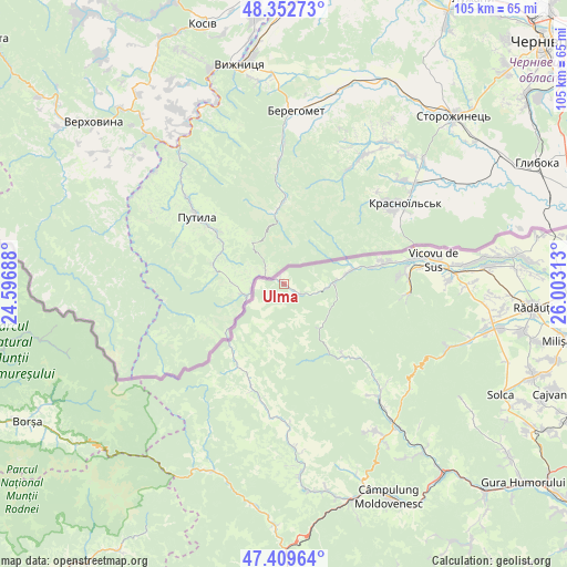
Ulma GPS coordinates[2]
47° 52' 59.988" North, 25° 18' 0" East
| Map corner | latitude | longitude |
|---|---|---|
| Upper-left | 48.35273°, | 24.59688° |
| Center: | 47.88333°, | 25.3° |
| Lower-right: | 47.40964°, | 26.00313° |
| Map W x H: | 104.9×104.9 km | = 65.2×65.2mi |
| max Lat: | 48.23793° ⇑2.3% North |
| Ulma: | 47.88333° |
| min Lat: | ⇓97.7% South 43.65638° |
| min Long | Ulma | max Long |
| 20.31667° | 25.3° | 29.65403° |
| W 51.3%⇐ | ⇒48.7% E |
Elevation
Elevation of Ulma is 685 m = 2247 ft, and this is 430.1 m = 1411 ft above average elevation for this country.
| Max E: |
1278 m = 4193 ft | 3.6% |
| Ulma | 685 m 2247 ft | |
| Avg. | 254.9 m = 836 ft | |
Min E: |
-2 m = -7 ft | 96.4% |
See also: Romania elevation on elevation.city.
Geographical zone
Ulma is located in North temperate zone (between Tropic of Cancer and the Arctic Circle). Distance of this North polar circle is 2077 km =1290.6 mi to North.| Distance of | km | miles | from Ulma |
|---|---|---|---|
| North Pole | 4682.9 | 2909.8 | to North |
| Arctic Circle | 2077 | 1290.6 | to North |
| Tropic Cancer | 2718.2 | 1689 | to South |
| Equator | 5324.1 | 3308.2 | to South |


Nearby cities:
15 places around Ulma: (largest is in red/bold)
• Argel
18.6 km =11.6 mi,  136°
136°
• Benia
24.4 km =15.2 mi,  185°
185°
• Bivolărie
26.7 km =16.6 mi,  82°
82°
• Bobeica
21.4 km =13.3 mi,  215°
215°
• Brodina
8.7 km =5.4 mi,  90°
90°
• Brodina
11.6 km =7.2 mi, 190°
• Demacușa
25.7 km =16 mi, 143°
• Falcău
13 km =8.1 mi, 76°
• Gura Putnei
22.1 km =13.7 mi, 85°
• Izvoarele Sucevei
17.2 km =10.7 mi,  210°
210°
• Lupcina
6.7 km =4.2 mi, 213°
• Moldova Suliţa
22.5 km =14 mi, 189°
• Putna
23.7 km =14.7 mi, 94°
• Rașca
22 km =13.7 mi,  133°
133°
• Straja
19 km =11.8 mi, 78°
Sources, notices
• [Note1] Compared only with cities in Romania existing in our database
• [Src1] Map data: © OpenStreetMap contributors (CC-BY-SA)
• [Src2] Other city data from geonames.org with taken over terms of usage.
• [Src3] Geographical zone / Annual Mean Temperature by Robert A. Rohde @ Wikipedia
