Tisa geodata
Tisa (Prahova) is a populated place; located in Romania in Europe/Bucharest (GMT+3) time zone. With population of 839 people, there are 4887 cities with bigger population in this country. Compared to other cities in Romania, 64% of cities are located further ↑North; 69.4% of cities are located further ←West and 51.5% of cities have higher elevation than Tisa. Note1


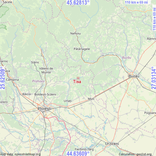
Tisa GPS coordinates[2]
45° 8' 3.372" North, 26° 19' 41.556" East
| Map corner | latitude | longitude |
|---|---|---|
| Upper-left | 45.62813°, | 25.62509° |
| Center: | 45.13427°, | 26.32821° |
| Lower-right: | 44.63609°, | 27.03134° |
| Map W x H: | 110.3×110.3 km | = 68.5×68.5mi |
| max Lat: | 48.23793° ⇑64% North |
| Tisa: | 45.13427° |
| min Lat: | ⇓36% South 43.65638° |
| min Long | Tisa | max Long |
| 20.31667° | 26.32821° | 29.65403° |
| W 69.4%⇐ | ⇒30.6% E |
Elevation
Elevation of Tisa is 204 m = 669 ft, and this is 50.9 m = 167 ft below average elevation for this country.
| Max E: |
1278 m = 4193 ft | 51.5% |
| Avg. | 254.9 m = 836 ft | |
| Tisa | 204 m = 669 ft | |
Min E: |
-2 m = -7 ft | 48.5% |
See also: Romania elevation on elevation.city.
Geographical zone
Tisa is located in North temperate zone (between Tropic of Cancer and the Arctic Circle). Distance of this North polar circle is 2382.7 km =1480.5 mi to North.| Distance of | km | miles | from Tisa |
|---|---|---|---|
| North Pole | 4988.6 | 3099.8 | to North |
| Arctic Circle | 2382.7 | 1480.5 | to North |
| Tropic Cancer | 2412.5 | 1499.1 | to South |
| Equator | 5018.5 | 3118.4 | to South |


Nearby cities:
15 places around Tisa: (largest is in red/bold)
• Apostolache
4.8 km =3 mi,  268°
268°
• Buda Crăciunești
6.8 km =4.2 mi,  40°
40°
• Chiojdeanca
6 km =3.7 mi,  306°
306°
• Coșerele
7.7 km =4.8 mi,  227°
227°
• Călugăreni
7.1 km =4.4 mi,  142°
142°
• Gornet-Cricov
7.4 km =4.6 mi,  220°
220°
• Lapoș
7.4 km =4.6 mi,  74°
74°
• Mireșu Mare
3.8 km =2.4 mi,  88°
88°
• Nucet
4.2 km =2.6 mi, 310°
• Podgoria
3.2 km =2 mi,  206°
206°
• Popești
8 km =5 mi,  247°
247°
• Salcia
5.5 km =3.4 mi,  4°
4°
• Sângeru
1.7 km =1.1 mi, 93°
• Trenu
7.3 km =4.5 mi,  321°
321°
• Tătaru
3.8 km =2.4 mi,  173°
173°
Sources, notices
• [Note1] Compared only with cities in Romania existing in our database
• [Src1] Map data: © OpenStreetMap contributors (CC-BY-SA)
• [Src2] Other city data from geonames.org with taken over terms of usage.
• [Src3] Geographical zone / Annual Mean Temperature by Robert A. Rohde @ Wikipedia
