Sângeru geodata
Sângeru (Prahova) is a seat of a second-order administrative division; located in Romania in Europe/Bucharest (GMT+3) time zone. With population of 5,271 people, there are 703 cities with bigger population in this country. Compared to other cities in Romania, 64.2% of cities are located further ↑North; 69.8% of cities are located further ←West and 59.4% of cities have lower elevation than Sângeru. Note1


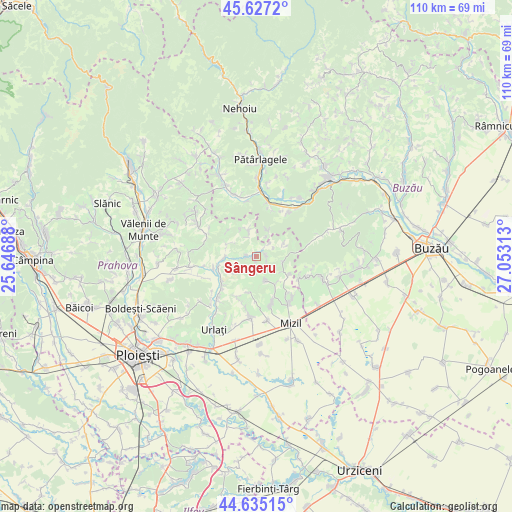
Sângeru GPS coordinates[2]
45° 7' 59.988" North, 26° 21' 0" East
| Map corner | latitude | longitude |
|---|---|---|
| Upper-left | 45.6272°, | 25.64688° |
| Center: | 45.13333°, | 26.35° |
| Lower-right: | 44.63515°, | 27.05313° |
| Map W x H: | 110.3×110.3 km | = 68.5×68.5mi |
| max Lat: | 48.23793° ⇑64.2% North |
| Sângeru: | 45.13333° |
| min Lat: | ⇓35.8% South 43.65638° |
| min Long | Sângeru | max Long |
| 20.31667° | 26.35° | 29.65403° |
| W 69.8%⇐ | ⇒30.2% E |
Elevation
Elevation of Sângeru is 260 m = 853 ft, and this is 5.1 m = 17 ft above average elevation for this country.
| Max E: |
1278 m = 4193 ft | 40.6% |
| Sângeru | 260 m 853 ft | |
| Avg. | 254.9 m = 836 ft | |
Min E: |
-2 m = -7 ft | 59.4% |
See also: Romania elevation on elevation.city.
Geographical zone
Sângeru is located in North temperate zone (between Tropic of Cancer and the Arctic Circle). Distance of this North polar circle is 2382.8 km =1480.6 mi to North.| Distance of | km | miles | from Sângeru |
|---|---|---|---|
| North Pole | 4988.7 | 3099.8 | to North |
| Arctic Circle | 2382.8 | 1480.6 | to North |
| Tropic Cancer | 2412.4 | 1499 | to South |
| Equator | 5018.4 | 3118.3 | to South |


Nearby cities:
15 places around Sângeru: (largest is in red/bold)
• Apostolache
6.5 km =4 mi,  270°
270°
• Buda Crăciunești
6 km =3.7 mi,  26°
26°
• Chiojdeanca
7.5 km =4.7 mi,  299°
299°
• Coșerele
9 km =5.6 mi,  235°
235°
• Călugăreni
6.1 km =3.8 mi,  154°
154°
• Gornet-Cricov
8.6 km =5.3 mi,  229°
229°
• Jugureni
8.7 km =5.4 mi,  115°
115°
• Lapoș
5.8 km =3.6 mi,  69°
69°
• Mireșu Mare
2.1 km =1.3 mi,  84°
84°
• Nucet
5.7 km =3.5 mi, 300°
• Podgoria
4.2 km =2.6 mi, 228°
• Salcia
5.7 km =3.5 mi,  346°
346°
• Tisa
1.7 km =1.1 mi, 273°
• Trenu
8.6 km =5.3 mi,  312°
312°
• Tătaru
3.9 km =2.4 mi,  199°
199°
Sources, notices
• [Note1] Compared only with cities in Romania existing in our database
• [Src1] Map data: © OpenStreetMap contributors (CC-BY-SA)
• [Src2] Other city data from geonames.org with taken over terms of usage.
• [Src3] Geographical zone / Annual Mean Temperature by Robert A. Rohde @ Wikipedia
