Telega geodata
Telega (Prahova) is a seat of a second-order administrative division; located in Romania in Europe/Bucharest (GMT+3) time zone. With population of 6,358 people, there are 482 cities with bigger population in this country. Compared to other cities in Romania, 64.2% of cities are located further ↑North; 58.8% of cities are located further ←West and 84.1% of cities have lower elevation than Telega. Note1


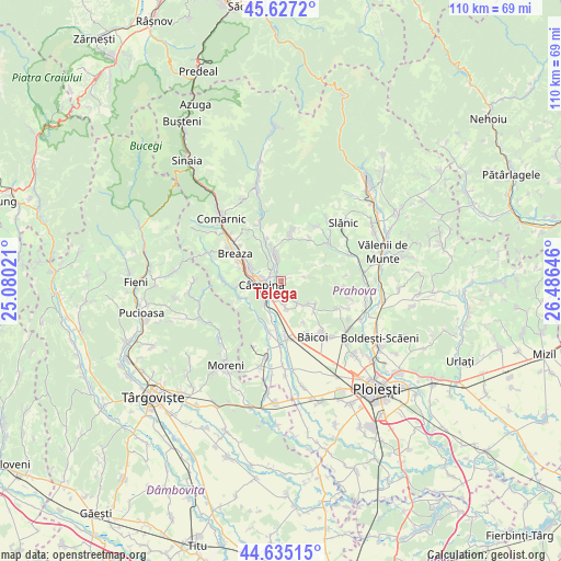
Telega GPS coordinates[2]
45° 7' 59.988" North, 25° 46' 59.988" East
| Map corner | latitude | longitude |
|---|---|---|
| Upper-left | 45.6272°, | 25.08021° |
| Center: | 45.13333°, | 25.78333° |
| Lower-right: | 44.63515°, | 26.48646° |
| Map W x H: | 110.3×110.3 km | = 68.5×68.5mi |
| max Lat: | 48.23793° ⇑64.2% North |
| Telega: | 45.13333° |
| min Lat: | ⇓35.8% South 43.65638° |
| min Long | Telega | max Long |
| 20.31667° | 25.78333° | 29.65403° |
| W 58.8%⇐ | ⇒41.2% E |
Elevation
Elevation of Telega is 436 m = 1430 ft, and this is 181.1 m = 594 ft above average elevation for this country.
| Max E: |
1278 m = 4193 ft | 15.9% |
| Telega | 436 m 1430 ft | |
| Avg. | 254.9 m = 836 ft | |
Min E: |
-2 m = -7 ft | 84.1% |
See also: Romania elevation on elevation.city.
Geographical zone
Telega is located in North temperate zone (between Tropic of Cancer and the Arctic Circle). Distance of this North polar circle is 2382.8 km =1480.6 mi to North.| Distance of | km | miles | from Telega |
|---|---|---|---|
| North Pole | 4988.7 | 3099.8 | to North |
| Arctic Circle | 2382.8 | 1480.6 | to North |
| Tropic Cancer | 2412.4 | 1499 | to South |
| Equator | 5018.4 | 3118.3 | to South |


Nearby cities:
15 places around Telega: (largest is in red/bold)
• Bobolia
5.4 km =3.4 mi,  216°
216°
• Brebu Megieșesc
3.9 km =2.4 mi,  350°
350°
• Brebu Mânăstirei
5.7 km =3.5 mi, 346°
• Buștenari
4.1 km =2.5 mi,  77°
77°
• Băneşti
3.9 km =2.4 mi,  199°
199°
• Cocorăștii Caplii
7.6 km =4.7 mi,  192°
192°
• Cornu de Jos
6.7 km =4.2 mi,  292°
292°
• Cornu de Sus
7.5 km =4.7 mi,  299°
299°
• Câmpina
3.9 km =2.4 mi,  258°
258°
• Doftana
2.3 km =1.4 mi,  35°
35°
• Melicești
3.9 km =2.4 mi,  34°
34°
• Mislea
5.2 km =3.2 mi,  141°
141°
• Plaiu Câmpinei
6.8 km =4.2 mi,  324°
324°
• Scorţeni
6.4 km =4 mi,  125°
125°
• Urleta
5.2 km =3.2 mi,  171°
171°
Sources, notices
• [Note1] Compared only with cities in Romania existing in our database
• [Src1] Map data: © OpenStreetMap contributors (CC-BY-SA)
• [Src2] Other city data from geonames.org with taken over terms of usage.
• [Src3] Geographical zone / Annual Mean Temperature by Robert A. Rohde @ Wikipedia
