Ştefăneşti geodata
Ştefăneşti (Vâlcea) is a seat of a second-order administrative division; located in Romania in Europe/Bucharest (GMT+3) time zone. With population of 3,663 people, there are 1346 cities with bigger population in this country. Compared to other cities in Romania, 82.4% of cities are located further ↑North; 65% of cities are located further →East and 62% of cities have higher elevation than Ştefăneşti. Note1


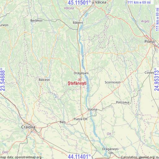
Ştefăneşti GPS coordinates[2]
44° 37' 0.012" North, 24° 15' 0" East
| Map corner | latitude | longitude |
|---|---|---|
| Upper-left | 45.11501°, | 23.54688° |
| Center: | 44.61667°, | 24.25° |
| Lower-right: | 44.11401°, | 24.95313° |
| Map W x H: | 111.3×111.3 km | = 69.2×69.2mi |
| max Lat: | 48.23793° ⇑82.4% North |
| Ştefăneşti: | 44.61667° |
| min Lat: | ⇓17.6% South 43.65638° |
| min Long | Ştefăneşti | max Long |
| 20.31667° | 24.25° | 29.65403° |
| W 35%⇐ | ⇒65% E |
Elevation
Elevation of Ştefăneşti is 159 m = 522 ft, and this is 95.9 m = 315 ft below average elevation for this country.
| Max E: |
1278 m = 4193 ft | 62% |
| Avg. | 254.9 m = 836 ft | |
| Ştefăneşti | 159 m = 522 ft | |
Min E: |
-2 m = -7 ft | 38% |
See also: Romania elevation on elevation.city.
Geographical zone
Ştefăneşti is located in North temperate zone (between Tropic of Cancer and the Arctic Circle). Distance of this Northern Tropic circle is 2355 km =1463.3 mi to South.| Distance of | km | miles | from Ştefăneşti |
|---|---|---|---|
| North Pole | 5046.2 | 3135.6 | to North |
| Arctic Circle | 2440.3 | 1516.3 | to North |
| Tropic Cancer | 2355 | 1463.3 | to South |
| Equator | 4960.9 | 3082.6 | to South |


Nearby cities:
15 places around Ştefăneşti: (largest is in red/bold)
• Boroșești
5.5 km =3.4 mi,  329°
329°
• Dobrușa
3.5 km =2.2 mi,  287°
287°
• Drăgăşani
3.9 km =2.4 mi,  19°
19°
• Fumureni
7.3 km =4.5 mi,  270°
270°
• Grădinari
5.7 km =3.5 mi,  166°
166°
• Lungeşti
7.7 km =4.8 mi,  223°
223°
• Petculești
2.6 km =1.6 mi,  148°
148°
• Poganu
7.3 km =4.5 mi,  47°
47°
• Runcu Mare
6.9 km =4.3 mi, 166°
• Stănești-Lunca
6.4 km =4 mi,  211°
211°
• Sutești
6.4 km =4 mi, 334°
• Verguleasa
6.4 km =4 mi, 54°
• Voiceşti
3.2 km =2 mi,  125°
125°
• Zlătărei
1.7 km =1.1 mi, 21°
• Șerbănești
3.2 km =2 mi,  188°
188°
Sources, notices
• [Note1] Compared only with cities in Romania existing in our database
• [Src1] Map data: © OpenStreetMap contributors (CC-BY-SA)
• [Src2] Other city data from geonames.org with taken over terms of usage.
• [Src3] Geographical zone / Annual Mean Temperature by Robert A. Rohde @ Wikipedia
