Verguleasa geodata
Verguleasa (Olt) is a seat of a second-order administrative division; located in Romania in Europe/Bucharest (GMT+3) time zone. With population of 3,439 people, there are 1461 cities with bigger population in this country. Compared to other cities in Romania, 81.6% of cities are located further ↑North; 63.5% of cities are located further →East and 66.3% of cities have higher elevation than Verguleasa. Note1


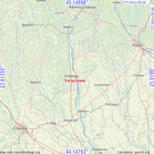
Verguleasa GPS coordinates[2]
44° 39' 0" North, 24° 19' 0.012" East
| Map corner | latitude | longitude |
|---|---|---|
| Upper-left | 45.14806°, | 23.61355° |
| Center: | 44.65°, | 24.31667° |
| Lower-right: | 44.14763°, | 25.0198° |
| Map W x H: | 111.2×111.2 km | = 69.1×69.1mi |
| max Lat: | 48.23793° ⇑81.6% North |
| Verguleasa: | 44.65° |
| min Lat: | ⇓18.4% South 43.65638° |
| min Long | Verguleasa | max Long |
| 20.31667° | 24.31667° | 29.65403° |
| W 36.5%⇐ | ⇒63.5% E |
Elevation
Elevation of Verguleasa is 142 m = 466 ft, and this is 112.9 m = 370 ft below average elevation for this country.
| Max E: |
1278 m = 4193 ft | 66.3% |
| Avg. | 254.9 m = 836 ft | |
| Verguleasa | 142 m = 466 ft | |
Min E: |
-2 m = -7 ft | 33.7% |
See also: Romania elevation on elevation.city.
Geographical zone
Verguleasa is located in North temperate zone (between Tropic of Cancer and the Arctic Circle). Distance of this Northern Tropic circle is 2358.7 km =1465.6 mi to South.| Distance of | km | miles | from Verguleasa |
|---|---|---|---|
| North Pole | 5042.4 | 3133.2 | to North |
| Arctic Circle | 2436.6 | 1514 | to North |
| Tropic Cancer | 2358.7 | 1465.6 | to South |
| Equator | 4964.6 | 3084.9 | to South |


Nearby cities:
15 places around Verguleasa: (largest is in red/bold)
• Boroșești
8.2 km =5.1 mi,  277°
277°
• Cungrea
5.6 km =3.5 mi,  70°
70°
• Călina
7.6 km =4.7 mi,  319°
319°
• Dobrușa
9 km =5.6 mi,  253°
253°
• Drăgăşani
4 km =2.5 mi,  270°
270°
• Dumitrești
3.7 km =2.3 mi,  359°
359°
• Petculești
7.1 km =4.4 mi,  213°
213°
• Poganu
1.2 km =0.7 mi,  7°
7°
• Sutești
8.3 km =5.2 mi, 284°
• Valea lui Alb
6.4 km =4 mi, 358°
• Verdea
8.4 km =5.2 mi,  303°
303°
• Voiceşti
6.2 km =3.9 mi, 205°
• Zlătărei
5.1 km =3.2 mi, 245°
• Ştefăneşti
6.4 km =4 mi,  234°
234°
• Șerbănești
9 km =5.6 mi,  219°
219°
Sources, notices
• [Note1] Compared only with cities in Romania existing in our database
• [Src1] Map data: © OpenStreetMap contributors (CC-BY-SA)
• [Src2] Other city data from geonames.org with taken over terms of usage.
• [Src3] Geographical zone / Annual Mean Temperature by Robert A. Rohde @ Wikipedia
