Ștefan cel Mare geodata
Ștefan cel Mare (Călăraşi) is a seat of a second-order administrative division; located in Romania in Europe/Bucharest (GMT+3) time zone. With population of 3,236 people, there are 1596 cities with bigger population in this country. Compared to other cities in Romania, 87.4% of cities are located further ↑North; 92.6% of cities are located further ←West and 94.4% of cities have higher elevation than Ștefan cel Mare. Note1


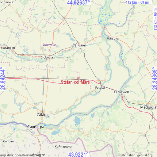
Ștefan cel Mare GPS coordinates[2]
44° 25' 35.004" North, 27° 38' 44.016" East
| Map corner | latitude | longitude |
|---|---|---|
| Upper-left | 44.92637°, | 26.94244° |
| Center: | 44.42639°, | 27.64556° |
| Lower-right: | 43.9221°, | 28.34869° |
| Map W x H: | 111.7×111.7 km | = 69.4×69.4mi |
| max Lat: | 48.23793° ⇑87.4% North |
| Ștefan cel Mare: | 44.42639° |
| min Lat: | ⇓12.6% South 43.65638° |
| min Long | Ștefan cel Mar | max Long |
| 20.31667° | 27.64556° | 29.65403° |
| W 92.6%⇐ | ⇒7.4% E |
Elevation
Elevation of Ștefan cel Mare is 37 m = 121 ft, and this is 217.9 m = 715 ft below average elevation for this country.
| Max E: |
1278 m = 4193 ft | 94.4% |
| Avg. | 254.9 m = 836 ft | |
| Ștefan cel Mare | 37 m = 121 ft | |
Min E: |
-2 m = -7 ft | 5.6% |
See also: Romania elevation on elevation.city.
Geographical zone
Ștefan cel Mare is located in North temperate zone (between Tropic of Cancer and the Arctic Circle). Distance of this Northern Tropic circle is 2333.8 km =1450.2 mi to South.| Distance of | km | miles | from Ștefan cel Mare |
|---|---|---|---|
| North Pole | 5067.3 | 3148.7 | to North |
| Arctic Circle | 2461.4 | 1529.4 | to North |
| Tropic Cancer | 2333.8 | 1450.2 | to South |
| Equator | 4939.8 | 3069.4 | to South |


Nearby cities:
15 places around Ștefan cel Mare: (largest is in red/bold)
• Borcea
13.3 km =8.3 mi,  141°
141°
• Buliga
14 km =8.7 mi,  123°
123°
• Feteşti
15.7 km =9.8 mi,  107°
107°
• Fetești-Gară
14.3 km =8.9 mi,  93°
93°
• Gâldău
13.6 km =8.5 mi,  171°
171°
• Iezeru
15.7 km =9.8 mi,  186°
186°
• Jegălia
14.1 km =8.8 mi,  183°
183°
• Movila
14.4 km =8.9 mi,  17°
17°
• Mărculești
18.7 km =11.6 mi,  326°
326°
• Perişoru
8 km =5 mi,  289°
289°
• Stelnica
18.9 km =11.7 mi, 93°
• Sudiţi
17.8 km =11.1 mi,  348°
348°
• Tudor Vladimirescu
14.5 km =9 mi,  274°
274°
• Unirea
17.8 km =11.1 mi, 183°
• Vlașca
16.5 km =10.3 mi,  101°
101°
Sources, notices
• [Note1] Compared only with cities in Romania existing in our database
• [Src1] Map data: © OpenStreetMap contributors (CC-BY-SA)
• [Src2] Other city data from geonames.org with taken over terms of usage.
• [Src3] Geographical zone / Annual Mean Temperature by Robert A. Rohde @ Wikipedia
