Perişoru geodata
Perişoru (Călăraşi) is a seat of a second-order administrative division; located in Romania in Europe/Bucharest (GMT+3) time zone. With population of 5,535 people, there are 631 cities with bigger population in this country. Compared to other cities in Romania, 86.8% of cities are located further ↑North; 91.6% of cities are located further ←West and 95% of cities have higher elevation than Perişoru. Note1


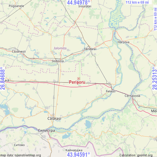
Perişoru GPS coordinates[2]
44° 27' 0" North, 27° 33' 0" East
| Map corner | latitude | longitude |
|---|---|---|
| Upper-left | 44.94978°, | 26.84688° |
| Center: | 44.45°, | 27.55° |
| Lower-right: | 43.94591°, | 28.25313° |
| Map W x H: | 111.6×111.6 km | = 69.3×69.3mi |
| max Lat: | 48.23793° ⇑86.8% North |
| Perişoru: | 44.45° |
| min Lat: | ⇓13.2% South 43.65638° |
| min Long | Perişoru | max Long |
| 20.31667° | 27.55° | 29.65403° |
| W 91.6%⇐ | ⇒8.4% E |
Elevation
Elevation of Perişoru is 35 m = 115 ft, and this is 219.9 m = 721 ft below average elevation for this country.
| Max E: |
1278 m = 4193 ft | 95% |
| Avg. | 254.9 m = 836 ft | |
| Perişoru | 35 m = 115 ft | |
Min E: |
-2 m = -7 ft | 5% |
See also: Romania elevation on elevation.city.
Geographical zone
Perişoru is located in North temperate zone (between Tropic of Cancer and the Arctic Circle). Distance of this Northern Tropic circle is 2336.5 km =1451.8 mi to South.| Distance of | km | miles | from Perişoru |
|---|---|---|---|
| North Pole | 5064.7 | 3147.1 | to North |
| Arctic Circle | 2458.8 | 1527.8 | to North |
| Tropic Cancer | 2336.5 | 1451.8 | to South |
| Equator | 4942.4 | 3071.1 | to South |


Nearby cities:
15 places around Perişoru: (largest is in red/bold)
• Bucu
17.8 km =11.1 mi,  345°
345°
• Ciulniţa
18.4 km =11.4 mi,  300°
300°
• Constantin Brâncoveanu
11.3 km =7 mi,  286°
286°
• Cosâmbeşti
15.2 km =9.4 mi,  322°
322°
• Dragalina
18.6 km =11.6 mi,  264°
264°
• Drajna Nouă
13.8 km =8.6 mi, 257°
• Gâldău
18.7 km =11.6 mi,  149°
149°
• Jegălia
17.9 km =11.1 mi,  158°
158°
• Movila
16.3 km =10.1 mi,  46°
46°
• Mărculești
13.3 km =8.3 mi, 348°
• Ograda
18.4 km =11.4 mi,  5°
5°
• Sudiţi
15.3 km =9.5 mi, 14°
• Săveni
18.5 km =11.5 mi,  25°
25°
• Tudor Vladimirescu
7 km =4.3 mi, 257°
• Ștefan cel Mare
8 km =5 mi,  109°
109°
Sources, notices
• [Note1] Compared only with cities in Romania existing in our database
• [Src1] Map data: © OpenStreetMap contributors (CC-BY-SA)
• [Src2] Other city data from geonames.org with taken over terms of usage.
• [Src3] Geographical zone / Annual Mean Temperature by Robert A. Rohde @ Wikipedia
