Slătioara geodata
Slătioara (Vâlcea) is a populated place; located in Romania in Europe/Bucharest (GMT+3) time zone. With population of 985 people, there are 4340 cities with bigger population in this country. Compared to other cities in Romania, 64.9% of cities are located further ↑North; 70.9% of cities are located further →East and 91.7% of cities have lower elevation than Slătioara. Note1


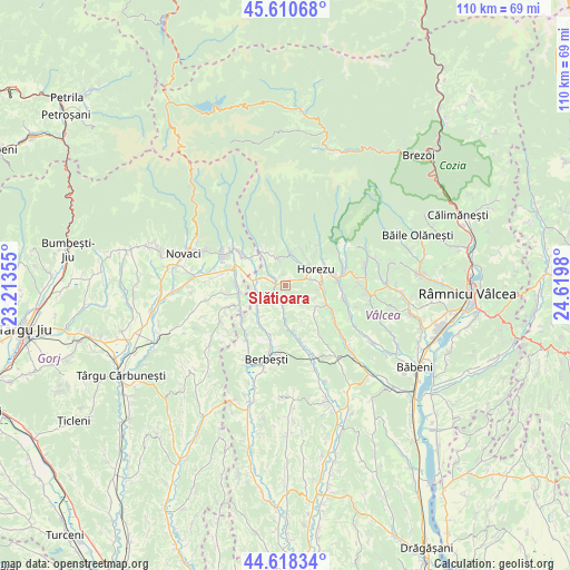
Slătioara GPS coordinates[2]
45° 7' 0.012" North, 23° 55' 0.012" East
| Map corner | latitude | longitude |
|---|---|---|
| Upper-left | 45.61068°, | 23.21355° |
| Center: | 45.11667°, | 23.91667° |
| Lower-right: | 44.61834°, | 24.6198° |
| Map W x H: | 110.3×110.3 km | = 68.5×68.5mi |
| max Lat: | 48.23793° ⇑64.9% North |
| Slătioara: | 45.11667° |
| min Lat: | ⇓35.1% South 43.65638° |
| min Long | Slătioara | max Long |
| 20.31667° | 23.91667° | 29.65403° |
| W 29.1%⇐ | ⇒70.9% E |
Elevation
Elevation of Slătioara is 544 m = 1785 ft, and this is 289.1 m = 948 ft above average elevation for this country.
| Max E: |
1278 m = 4193 ft | 8.3% |
| Slătioara | 544 m 1785 ft | |
| Avg. | 254.9 m = 836 ft | |
Min E: |
-2 m = -7 ft | 91.7% |
See also: Romania elevation on elevation.city.
Geographical zone
Slătioara is located in North temperate zone (between Tropic of Cancer and the Arctic Circle). Distance of this North polar circle is 2384.7 km =1481.8 mi to North.| Distance of | km | miles | from Slătioara |
|---|---|---|---|
| North Pole | 4990.6 | 3101 | to North |
| Arctic Circle | 2384.7 | 1481.8 | to North |
| Tropic Cancer | 2410.6 | 1497.9 | to South |
| Equator | 5016.5 | 3117.1 | to South |


Nearby cities:
15 places around Slătioara: (largest is in red/bold)
• Cireșu
6 km =3.7 mi,  183°
183°
• Dianu
4 km =2.5 mi,  148°
148°
• Gorunești
2.8 km =1.7 mi,  223°
223°
• Greci
6 km =3.7 mi,  244°
244°
• Horezu
8.7 km =5.4 mi,  64°
64°
• Izvoru Rece
5.8 km =3.6 mi,  347°
347°
• Mateeşti
7.6 km =4.7 mi, 223°
• Milostea
6.4 km =4 mi,  278°
278°
• Mogești
0 km =0 mi,  0°
0°
• Măldăreşti
6.5 km =4 mi,  90°
90°
• Măldăreștii de Jos
7.9 km =4.9 mi,  97°
97°
• Racovița
8.5 km =5.3 mi,  313°
313°
• Rugetu
4.4 km =2.7 mi, 308°
• Stroeşti
3.9 km =2.4 mi,  199°
199°
• Vaideeni
5.7 km =3.5 mi,  13°
13°
Sources, notices
• [Note1] Compared only with cities in Romania existing in our database
• [Src1] Map data: © OpenStreetMap contributors (CC-BY-SA)
• [Src2] Other city data from geonames.org with taken over terms of usage.
• [Src3] Geographical zone / Annual Mean Temperature by Robert A. Rohde @ Wikipedia
