Sânpaul geodata
Sânpaul (Arad) is a populated place; located in Romania in Europe/Bucharest (GMT+3) time zone. With population of 626 people, there are 6038 cities with bigger population in this country. Compared to other cities in Romania, 61% of cities are located further ↓South; 98.5% of cities are located further →East and 77.4% of cities have higher elevation than Sânpaul. Note1


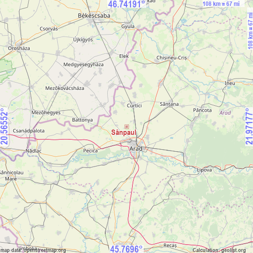
Sânpaul GPS coordinates[2]
46° 15' 28.476" North, 21° 16' 7.104" East
| Map corner | latitude | longitude |
|---|---|---|
| Upper-left | 46.74191°, | 20.56552° |
| Center: | 46.25791°, | 21.26864° |
| Lower-right: | 45.7696°, | 21.97177° |
| Map W x H: | 108.1×108.1 km | = 67.2×67.2mi |
| max Lat: | 48.23793° ⇑39% North |
| Sânpaul: | 46.25791° |
| min Lat: | ⇓61% South 43.65638° |
| min Long | Sânpaul | max Long |
| 20.31667° | 21.26864° | 29.65403° |
| W 1.5%⇐ | ⇒98.5% E |
Elevation
Elevation of Sânpaul is 103 m = 338 ft, and this is 151.9 m = 498 ft below average elevation for this country.
| Max E: |
1278 m = 4193 ft | 77.4% |
| Avg. | 254.9 m = 836 ft | |
| Sânpaul | 103 m = 338 ft | |
Min E: |
-2 m = -7 ft | 22.6% |
See also: Romania elevation on elevation.city.
Geographical zone
Sânpaul is located in North temperate zone (between Tropic of Cancer and the Arctic Circle). Distance of this North polar circle is 2257.8 km =1402.9 mi to North.| Distance of | km | miles | from Sânpaul |
|---|---|---|---|
| North Pole | 4863.7 | 3022.2 | to North |
| Arctic Circle | 2257.8 | 1402.9 | to North |
| Tropic Cancer | 2537.5 | 1576.7 | to South |
| Equator | 5143.4 | 3196 | to South |


Nearby cities:
15 places around Sânpaul: (largest is in red/bold)
• Andrei Șaguna
10 km =6.2 mi,  70°
70°
• Arad
9.1 km =5.7 mi,  155°
155°
• Curtici
10.5 km =6.5 mi,  13°
13°
• Dorobanți
10.4 km =6.5 mi,  349°
349°
• Felnac
18.2 km =11.3 mi,  210°
210°
• Fântânele
17.4 km =10.8 mi,  149°
149°
• Horia
15.9 km =9.9 mi,  110°
110°
• Iratoşu
8.4 km =5.2 mi,  321°
321°
• Livada
9.7 km =6 mi, 113°
• Macea
14.2 km =8.8 mi, 9°
• Turnu
10.9 km =6.8 mi,  269°
269°
• Vladimirescu
14.4 km =8.9 mi,  135°
135°
• Zimandu Nou
10.5 km =6.5 mi, 74°
• Zădăreni
14.4 km =8.9 mi,  195°
195°
• Şofronea
2.6 km =1.6 mi, 67°
Sources, notices
• [Note1] Compared only with cities in Romania existing in our database
• [Src1] Map data: © OpenStreetMap contributors (CC-BY-SA)
• [Src2] Other city data from geonames.org with taken over terms of usage.
• [Src3] Geographical zone / Annual Mean Temperature by Robert A. Rohde @ Wikipedia
