Şelaru geodata
Şelaru (Dâmboviţa) is a seat of a second-order administrative division; located in Romania in Europe/Bucharest (GMT+3) time zone. With population of 3,924 people, there are 1201 cities with bigger population in this country. Compared to other cities in Romania, 85.9% of cities are located further ↑North; 51.2% of cities are located further ←West and 64.9% of cities have higher elevation than Şelaru. Note1


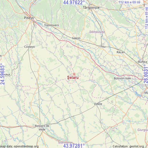
Şelaru GPS coordinates[2]
44° 28' 36.012" North, 25° 17' 59.892" East
| Map corner | latitude | longitude |
|---|---|---|
| Upper-left | 44.97622°, | 24.59685° |
| Center: | 44.47667°, | 25.29997° |
| Lower-right: | 43.97281°, | 26.0031° |
| Map W x H: | 111.6×111.6 km | = 69.3×69.3mi |
| max Lat: | 48.23793° ⇑85.9% North |
| Şelaru: | 44.47667° |
| min Lat: | ⇓14.1% South 43.65638° |
| min Long | Şelaru | max Long |
| 20.31667° | 25.29997° | 29.65403° |
| W 51.2%⇐ | ⇒48.8% E |
Elevation
Elevation of Şelaru is 147 m = 482 ft, and this is 107.9 m = 354 ft below average elevation for this country.
| Max E: |
1278 m = 4193 ft | 64.9% |
| Avg. | 254.9 m = 836 ft | |
| Şelaru | 147 m = 482 ft | |
Min E: |
-2 m = -7 ft | 35.1% |
See also: Romania elevation on elevation.city.
Geographical zone
Şelaru is located in North temperate zone (between Tropic of Cancer and the Arctic Circle). Distance of this Northern Tropic circle is 2339.4 km =1453.6 mi to South.| Distance of | km | miles | from Şelaru |
|---|---|---|---|
| North Pole | 5061.7 | 3145.2 | to North |
| Arctic Circle | 2455.8 | 1526 | to North |
| Tropic Cancer | 2339.4 | 1453.6 | to South |
| Equator | 4945.3 | 3072.9 | to South |


Nearby cities:
15 places around Şelaru: (largest is in red/bold)
• Babaroaga
11.6 km =7.2 mi,  312°
312°
• Butești
11.5 km =7.1 mi,  146°
146°
• Ciurari-Deal
11.6 km =7.2 mi,  114°
114°
• Drăghinești
11.2 km =7 mi,  116°
116°
• Fierbinți
3.6 km =2.2 mi,  344°
344°
• Glogoveanu
3.8 km =2.4 mi,  76°
76°
• Negreni
11.1 km =6.9 mi,  228°
228°
• Negrenii de Sus
11 km =6.8 mi, 234°
• Poeni
8.9 km =5.5 mi,  162°
162°
• Siliştea
11.1 km =6.9 mi, 159°
• Slobozia
7.1 km =4.4 mi,  319°
319°
• Sârbeni
6.7 km =4.2 mi,  99°
99°
• Udeni
10.4 km =6.5 mi, 97°
• Vişina
12.2 km =7.6 mi,  12°
12°
• Ştefan cel Mare
4.8 km =3 mi,  292°
292°
Sources, notices
• [Note1] Compared only with cities in Romania existing in our database
• [Src1] Map data: © OpenStreetMap contributors (CC-BY-SA)
• [Src2] Other city data from geonames.org with taken over terms of usage.
• [Src3] Geographical zone / Annual Mean Temperature by Robert A. Rohde @ Wikipedia
