Babaroaga geodata
Babaroaga (Arges) is a populated place; located in Romania in Europe/Bucharest (GMT+3) time zone. With population of 890 people, there are 4660 cities with bigger population in this country. Compared to other cities in Romania, 84.2% of cities are located further ↑North; 50.1% of cities are located further →East and 57.4% of cities have higher elevation than Babaroaga. Note1


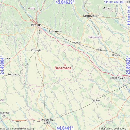
Babaroaga GPS coordinates[2]
44° 32' 50.46" North, 25° 11' 35.376" East
| Map corner | latitude | longitude |
|---|---|---|
| Upper-left | 45.04629°, | 24.49004° |
| Center: | 44.54735°, | 25.19316° |
| Lower-right: | 44.0441°, | 25.89629° |
| Map W x H: | 111.4×111.4 km | = 69.2×69.2mi |
| max Lat: | 48.23793° ⇑84.2% North |
| Babaroaga: | 44.54735° |
| min Lat: | ⇓15.8% South 43.65638° |
| min Long | Babaroaga | max Long |
| 20.31667° | 25.19316° | 29.65403° |
| W 49.9%⇐ | ⇒50.1% E |
Elevation
Elevation of Babaroaga is 176 m = 577 ft, and this is 78.9 m = 259 ft below average elevation for this country.
| Max E: |
1278 m = 4193 ft | 57.4% |
| Avg. | 254.9 m = 836 ft | |
| Babaroaga | 176 m = 577 ft | |
Min E: |
-2 m = -7 ft | 42.6% |
See also: Romania elevation on elevation.city.
Geographical zone
Babaroaga is located in North temperate zone (between Tropic of Cancer and the Arctic Circle). Distance of this Northern Tropic circle is 2347.3 km =1458.5 mi to South.| Distance of | km | miles | from Babaroaga |
|---|---|---|---|
| North Pole | 5053.9 | 3140.3 | to North |
| Arctic Circle | 2448 | 1521.1 | to North |
| Tropic Cancer | 2347.3 | 1458.5 | to South |
| Equator | 4953.2 | 3077.8 | to South |


Nearby cities:
15 places around Babaroaga: (largest is in red/bold)
• Broșteni
13.9 km =8.6 mi,  62°
62°
• Bârlogu
12.5 km =7.8 mi,  314°
314°
• Fierbinți
8.7 km =5.4 mi,  120°
120°
• Izvoru
11.8 km =7.3 mi,  239°
239°
• Morteni
13.6 km =8.5 mi,  13°
13°
• Mozăceni
3 km =1.9 mi,  315°
315°
• Neajlovu
13.7 km =8.5 mi,  24°
24°
• Negraşi
8.4 km =5.2 mi, 314°
• Purcăreni
12.1 km =7.5 mi,  202°
202°
• Răscăeți
7.9 km =4.9 mi,  50°
50°
• Slobozia
4.6 km =2.9 mi, 122°
• Slobozia
13.5 km =8.4 mi, 201°
• Vişina
11.8 km =7.3 mi,  70°
70°
• Şelaru
11.6 km =7.2 mi,  132°
132°
• Ştefan cel Mare
7.3 km =4.5 mi,  146°
146°
Sources, notices
• [Note1] Compared only with cities in Romania existing in our database
• [Src1] Map data: © OpenStreetMap contributors (CC-BY-SA)
• [Src2] Other city data from geonames.org with taken over terms of usage.
• [Src3] Geographical zone / Annual Mean Temperature by Robert A. Rohde @ Wikipedia
